| Reference: | S48919 |
| Author | Jean-Denis Barbié du Bocage |
| Year: | 1846 |
| Zone: | Africa |
| Printed: | Paris |
| Measures: | 255 x 335 mm |
| Reference: | S48919 |
| Author | Jean-Denis Barbié du Bocage |
| Year: | 1846 |
| Zone: | Africa |
| Printed: | Paris |
| Measures: | 255 x 335 mm |
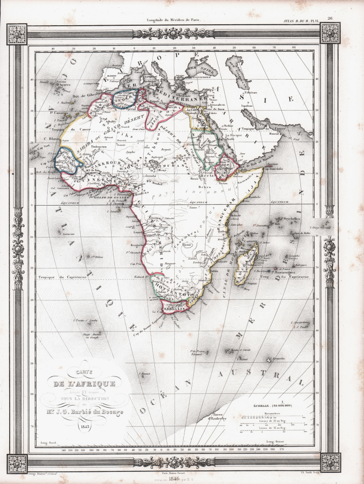
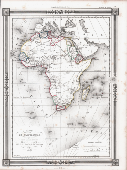
Map of Africa by J. G. Barbie du Bocage. Shows the continent of Africa situated high on the page. Labels the costal kingdoms and colonies including Zanzibar, Biafra, Senegabia, Algeria, Maroco, Abyssinia, Nubia, the Cape Colony and Egypt. Also denotes various tribal regions including the lands of the Hottentots, The Bambara, the Behrs and others.
Prepared by J. G. Barbie du Bocage for publication as plate no. 33 in Maison Basset's 1852 edition of Atlas Illustre Destine a l'enseignement de la Geographie elementaire.
Maison Basset (1819 - 1865) was a French publishing concern active through the mid to late 19th century. The firm can trace their roots to André Basset (or Bassett) (fl. 1768 - 1784), who starting publishing maps, prints, and books around 1768. Maison Basset, also Chez Basset, is the imprint under which the heirs of Paul-André Basset (1785 - 1819) published the works of such prominent French cartographers and engravers as Barbie du Bocage, A. Vuillemin, J. B. Charle, V. Levasseur, Tu. Duvotenay, H. Dufor, F. E. George, and others. Their library of publications is diverse and vast, but heavily focused on medical and scientific texts, including several important atlases.
Jean Denis Barbie du Bocage (1760 - 1825) and his son Jean-Guillaume Barbie du Bocage (1795 - 1848) were French cartographers and cosmographers active in Paris in the late 18th and early 19th centuries. The oldest of the Barbie du Bocage, Jean Denis, trained as a cartographer and engraver in the workshops of J. B. B. d'Anville. Jean Denis held the position of Royal Librarian of France while Jean-Guillaume became Geographe du Ministere des Affaires Etrangeres.
Copper engraving with original outline colour, some foxing, otherwise good condition.
Jean-Denis Barbié du Bocage (Parigi 1760 - 1825)
|
Jean Denis Barbie du Bocage (1760 - 1825) and his son Jean-Guillaume Barbie du Bocage (1795 - 1848) were French cartographers and cosmographers active in Paris during late 18th and early 19th centuries. The elder Barbie du Bocage, Jean Denis, was trained as a cartographer and engraver in the workshops of mapmaking legend J. B. B. d'Anville. At some point Jean Denis held the post of Royal Librarian of France and it was through is associations with d'Anville that the d'Anville collection of nearly 9000 maps was acquired by French Ministry of Foreign Affairs. The younger Barbie du Bocage, Jean-Guillaume, acquired a position shortly afterwards at the Ministry of Foreign Affairs and, in time, became its head, with the title of Geographe du Ministere des Affaires Etrangeres.
|