

| Reference: | S21871 |
| Author | Giovanni Antonio RIZZI ZANNONI |
| Year: | 1808 ca. |
| Zone: | Ponza, Ventotene |
| Measures: | 765 x 515 mm |


| Reference: | S21871 |
| Author | Giovanni Antonio RIZZI ZANNONI |
| Year: | 1808 ca. |
| Zone: | Ponza, Ventotene |
| Measures: | 765 x 515 mm |
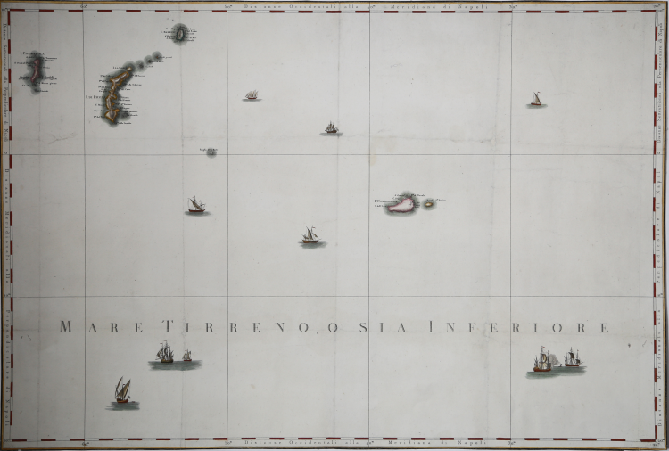
Map of the Pontine Islands taken from the Atlante Geografico del Regno di Napoli compito e rettificato sotto i felici auspicj di Giuseppe Napoleone I re di Napoli e di Sicilia, Naples 1808. The Atlas, in 31 sheets and at a scale of 1:114,545 (Valerio 1993, p. 126), was completed in 1812. The title was changed in 1815, upon the return of the Bourbons to the throne of Naples: replacing the phrase compito e rettificato with delineato per ordine di Ferdinando IV Re delle. The work, in fact, had been commissioned in 1781 by Ferdinand IV of Naples to the Paduan geographer Giovanni Antonio Rizzi Zannoni.
The importance of this atlas lies in the fact that it was the first attempt to produce a large-scale cartography for the southern regions, geodetically measured and surveyed on the ground, no longer based only on the processing of previous maps.
The Geographical Atlas of the Kingdom of Naples, which is one of the most important cartographic achievements in the eighteenth century Italian, is part of a broader ideological and cultural movement, headed by Abbot Ferdinando Galiani, according to which the "policy of use of resources" should be based on a "thorough knowledge of the territory.
Etching, with fine later hand colour, good condition.
Giovanni Antonio RIZZI ZANNONI (1736 - 1814)
|
Rizzi Zannoni was a noted astronomer, surveyor and mathematician of great versatility. His achieevements included a large scale map of Poland, appointmenys as Geographer to the Venetian Republic and as Hydrographer to the Dèpot de Marine in Paris. The maps in his various atlases were beatifully engraved, showing minute details and embellished with elaborate cartouches. His earlier atlases were published in Paris but his later works first appeared in Naples.
Principali pubblicazioni:
1762 Atlas géographique
1763 Atlas Géographique et militaire
1765 Le petit Neptune Francois
1772 Carte Générale de la Pologne
1792 Atlante Maritimo delle due Sicilie
1795 Nuova carta della Lombardia
|