

| Reference: | s31409 |
| Author | Giovanni Maria CASSINI |
| Year: | 1788 |
| Zone: | America |
| Printed: | Rome |
| Measures: | 475 x 350 mm |


| Reference: | s31409 |
| Author | Giovanni Maria CASSINI |
| Year: | 1788 |
| Zone: | America |
| Printed: | Rome |
| Measures: | 475 x 350 mm |
- FIRST EDITION -
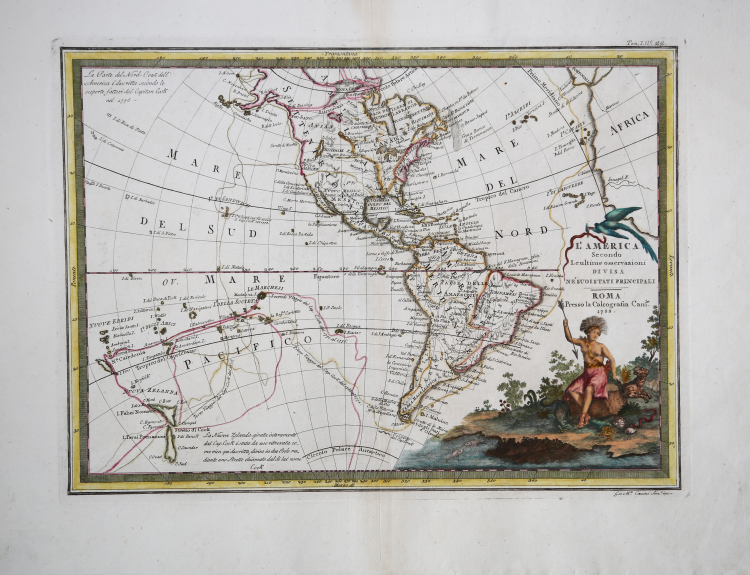
Cassini's map of America shows Captain James Cook's routes across the South Pacific, Hawaii, New Zealand, and the northwest coast of America during his three voyages between 1668 and 1778. A note at the bottom describes Cook's discovery of the passage between the islands of New Zealand. Below the Magellanic Land is depicted the mythical land Drake would have seen during his passage to the Pacific. An unusual feature of the map is a massive "Moozemlek" lake, a name that began appearing on maps nearly 100 years earlier as Moozemlek Country on the maps of Homann and others. This reference goes back to La Hontan's letter from Michilimackinac dated May 28, 1689, in which she describes her travels on the "Long River." La Hontan relates that while camping with the Gnacsitare Indians on the Long River, he met four Moozemlek Indians, held as slaves, who told him the details of their lands. The location of the Pais de Moozemlek would remain in the region for more than 100 years.
The Italian painter and engraver, Giovanni Maria Cassini, produced this attractive map as part of his epic three-volume atlas.
Published in: Nuovo atlante geografico universale delineato sulle ultime osservazioni. Roma, Calcografia camerale, 1792-1801.
Cassini was geographer and cartographer but he was also good at engraving architectural items and perspectives – he was one of the best disciples Giovanni Battista Piranesi had. Moreover, Cassini was one of the last artists to engrave spheres in the XVIII century and his globes were quite famous and widespread, and realized the most important Italian Atlas of the XVIII century; his maps always bear a cartouche, extremely rich in colours and details.
Copperplate with fine original hand colour with addition on the cartouche, in very good condition.
Giovanni Maria CASSINI (1745 - 1824)
|
Giovanni Maria Cassini was a fine Italian engraver, globe maker and painter. He did most of his work in Rome, and was not a member of the French Cassini family (a French Giovanni Maria Cassini was bor 120 years earlier). In 1792 Cassini published in Rome Vol. 1 of his atlas Nuovo Atlante Geografico Universale. This contained two celestial hemispheres printed in 1790, which were labeled Planisfero Celeste Settentrionale and Meridionale. Similar to Zatta's hemispheric prints, in the corners were beautiful drawings of famous observatories: Collegio Romano, Bologna, Milan and Padua in the northern plate, and Paris, Cassel, Greenwich and Copenaghen in the southern plate. Vol. 2 of this atlas was published in 1797, Vol. 3 in 1801.
|