

| Reference: | s17118 |
| Author | Gabriel DOPPELMAIER |
| Year: | 1742 |
| Zone: | Celestial Chart |
| Printed: | Nurnberg |
| Measures: | 590 x 490 mm |


| Reference: | s17118 |
| Author | Gabriel DOPPELMAIER |
| Year: | 1742 |
| Zone: | Celestial Chart |
| Printed: | Nurnberg |
| Measures: | 590 x 490 mm |
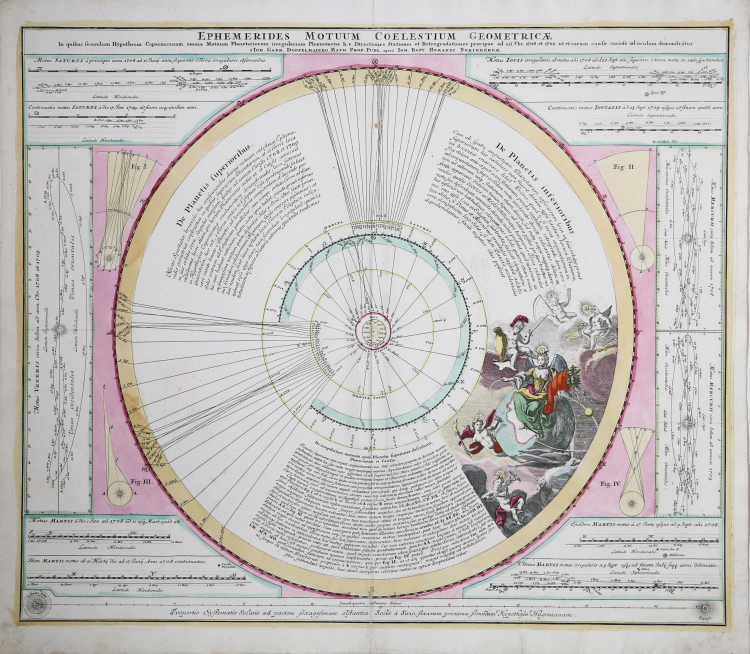
Copper engraved map of the planetary motion as per observations of 1708 and 1709 by J. G. Doppelmaier.
The left hand lunar map, composed by Hevelius, is a considered a foundational map in the science of Selenography – or lunar cartography. This map first appeared in Hevelius' 1647 work Selenographia which laid the groundwork for most subsequent lunar cartographic studies. Here the moon is presented as it can never be seen from Earth, at a greater than 360 degrees and with all visible features given equal weight. In this map Hevelius also establishes the convention of mapping the lunar surface as if illuminated from a single source – in this case morning light. The naming conventions he set forth, which associate lunar features with terrestrial locations such as 'Asia Minor,' 'Persia,' 'Sicilia,' etcetera were popular until the middle of the 18th century when Riccioli's nomenclature took precedence.
The Riccioli map, on the right, is more properly known as the Riccioli-Grimaldi map, for fellow Jesuit Francesco Grimaldi with whom Riccioli composed the chart. This map first appeared in Riccioli and Grimaldi's 1651 Almagestum Novum. This was a significant lunar chart and offered an entirely new nomenclature which, for the most part, is still in use today. Curiously, though Riccioli, as a devout Jesuit, composed several treatises denouncing Copernican theory, he chose to name one of the Moon's most notable features after the astronomer – perhaps suggesting that he was a secret Copernicus sympathizer. Other well-known lunar features named by Riccioli include the Sea of Tranquility where Apollo 11 landed and where Neil Armstrong became the first human to set foot on the moon's surface.
The upper left and right hand quadrants feature decorative allegorical cartouche work that include images of angelic children looking through a telescope and a representation of the ancient Greek Moon goddess Selene. Additional mini-maps show the moon in various phases of its monthly cycle. Below the map proper extensive Latin text discusses Selenography.
Also showing the Hooke's calculation of the distance between the Sun and Sirius.
This is map number 8 of the Atlas Coelestis (1742) by Johann Gabriel Doppelmaier that the professor of mathematics at the Aegidien Gymnasium in Nuremberg, referring in part to the work of Pardies, wrote around 1720 on behalf of the printing house founded in the same city in 1702 by cartographer Johann Baptist Homann.
Gabriel DOPPELMAIER (1677-1750)
|
Doppelmayr’s best-known astronomical work is his Atlas Coelestis in quo Mundus Spectabilis et in eodem Stellarum omnium Phoenomena notabilia, circa ipsarum Lumen, Figuram, Faciem, Motum, Eclipses, Occultationes, Transitus, Magnitudines, Distantias, aliaque secundum Nic. Copernici et ex parte Tychonis de Brahe Hipothesin. Nostri intuitu, specialiter, respectu vero ad apparentias planetarum indagatu possibiles e planetis primariis, et e luna habito, generaliter celeberrimorum astronomorum observationibus graphice descripta exhibentur, cum tabulis majoribus XXX, published in 1742 by the heirs of Homann in Nuremberg. In this atlas, Doppelmayr collected most of the astronomical and cosmographical plates which he had prepared over the years for the Homann publishing firm and which had appeared in several of their atlases. These earlier atlases allow us to infer approximate dates for the design and preparation many of Doppelmayr’s cosmographical plates.
The earliest ones are plates 2 and 11 as they were already included in Homann’s first atlas, the Neuer Atlas (Nuremberg, 1707). Plates 3 and 7 to 10 were first published in Homann’s Atlas von hundert Charten (Nuremberg, 1712), whereas plates 1, 4 and 15 to 25 can be dated between 1716 and 1724 as they were not included in Homann’s Grossen Atlas (Nuremberg, 1716), but are mentioned in Hager’s list of plates sold by Homann at his death in 1724.
|