

| Reference: | S5048 |
| Author | Robert Jean JANVIER |
| Year: | 1763 ca. |
| Zone: | Netherlands |
| Printed: | Paris |
| Measures: | 470 x 332 mm |


| Reference: | S5048 |
| Author | Robert Jean JANVIER |
| Year: | 1763 ca. |
| Zone: | Netherlands |
| Printed: | Paris |
| Measures: | 470 x 332 mm |
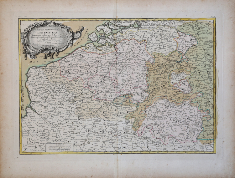
Decorative map of the Southern part of the Low Countries, published in Paris.
Janvier's map covers modern day Belgium and Luxembourg, with adjacent parts of France, Holland and Germany.
It is divided into counties and duchies with color coding according to region. excellent detail is offered throughout, with mountains, rivers, forests, national boundaries, regional boundaries, forts, and cities identified.
In the upper right corner, decorative cartouche with title.
Robert Jean JANVIER (Attivo 1746 - 1776)
|
A French cartographer who worked in Paris from about 1746. There is some confusion about his Christian name but his maps usually bore the inscriptions”Le Sieur Janvier”. In addition to works published under his own name by Jean Lattré in Bordeaux and C. F. Delamarche in Paris, he collaborated with other cartographers and publishers, producing a considerable numbers of maps, many of which were used in general atlases by William Fadan, P.Santini and others.
1751 Map in Atlas de Geographie ancienne et moderne by Jean de Beaurain
1751 (with S.G. Longchamps) Map of France
1754 Map of America
1759 Les Isles Britanniques
1779,1791 re-issued
c.1760 Maps of the world,the Continents and France and Germany
1762 re-issued on a reduced scalein Atlas Moderne
1763 re-issued in Atlas abrégé et portraif by P. M. Gournè
1762 Atlas Moderne ou collection de Cartes
1771 re-issued
1772 Map of America
1776-84 Maps in Atlas Universel by P.Santini
|