

| Reference: | CO-183 |
| Author | Robert WILKINSON |
| Year: | 1794 ca. |
| Zone: | Central Italy |
| Measures: | 240 x 300 mm |


| Reference: | CO-183 |
| Author | Robert WILKINSON |
| Year: | 1794 ca. |
| Zone: | Central Italy |
| Measures: | 240 x 300 mm |
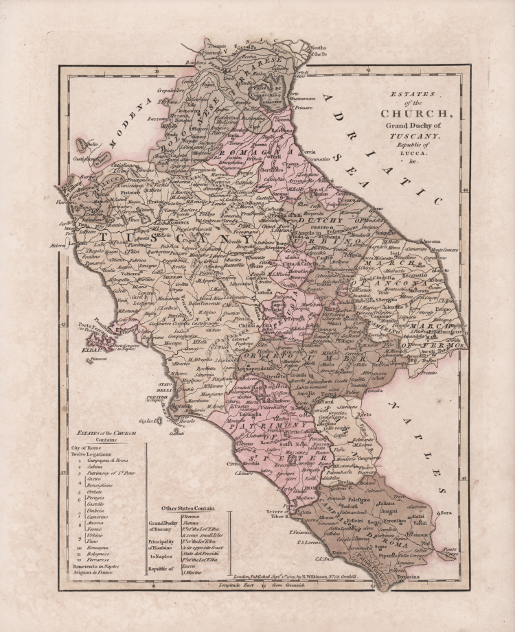
Carta tratta dall'opera A General Atlas, being a Collection of Maps of the World and Quarters, the principal empires, kingdoms ..., Londra, 1794. Ristampe 1800, 1802, 1808, 1809, 1810, 1816.
Edizione del 1809.
“La graduazione ai margini, di 10' in 10', va da 41° 02' a 45° lat. e da 10° 27' a 14° 24' long. Orientatata con la rosa dei venti, ha scala in miglia terrestri britanniche. Tavola di modesto significato e interesse sia sul piano tecnico-cartografico che per contenuti. Di dimensioni alquanto contenute a tener conto del territorio raffigurato, riduce all'essenziale ogni elemento geografico sia fisico che antropico. Le varie partizioni territoriali sono riportate con le scritture (Perugino, Umbria ecc.), ma senza distinguere i confini. Particolare attenzione sembra riservata all'orografia, ma l'apposito e solito segno convenzionale (monticelli prospettici) procura un’impressione di spiccata montuosità per zone soltanto collinari (Toscana, Marche). Come in molte altre carte settecentesche, il gruppo del Monte Vettore è segnalato come Monte della Sibilla, preceduto verso nord dall'oronimo Appennino M. Il Regno di Napoli e il Ducato di Modena vengono indicati con Naples e Modena, senza preporre altra qualificazione” (cfr. "Le antiche terre del Ducato di Spoleto", p. 220).
Acquaforte, coloritura successiva, in buono stato di conservazione.
|
F. Ronca e A. Sorbini (a cura di) "Le antiche terre del Ducato di Spoleto", p. 220, 96.
|
Robert WILKINSON (Attivo a Londra tra il 1768 - 1825)
|
Robert Wilkinson was a London based map and atlas publisher active in the late 18th and early 19th centuries. Most of Wilkinson's maps were derived from the earlier work of John Bowles, one of the preeminent English map publishers of the 18th century. Wilkinson's acquired the Bowles map plate library following the cartographer's death in 1779. Wilkinson updated and tooled the Bowles plates over several years until, in 1794, he issued his fully original atlas, The General Atlas of the World. This popular atlas was profitably reissued in numerous editions until about 1825 when Wilkinson died.
|
|
F. Ronca e A. Sorbini (a cura di) "Le antiche terre del Ducato di Spoleto", p. 220, 96.
|
Robert WILKINSON (Attivo a Londra tra il 1768 - 1825)
|
Robert Wilkinson was a London based map and atlas publisher active in the late 18th and early 19th centuries. Most of Wilkinson's maps were derived from the earlier work of John Bowles, one of the preeminent English map publishers of the 18th century. Wilkinson's acquired the Bowles map plate library following the cartographer's death in 1779. Wilkinson updated and tooled the Bowles plates over several years until, in 1794, he issued his fully original atlas, The General Atlas of the World. This popular atlas was profitably reissued in numerous editions until about 1825 when Wilkinson died.
|