
| Reference: | MS8201 |
| Author | Pietro TODESCHI |
| Year: | 1670 ca. |
| Zone: | Central Italy |
| Printed: | Bologna |
| Measures: | 490 x 378 mm |
| Reference: | MS8201 |
| Author | Pietro TODESCHI |
| Year: | 1670 ca. |
| Zone: | Central Italy |
| Printed: | Bologna |
| Measures: | 490 x 378 mm |
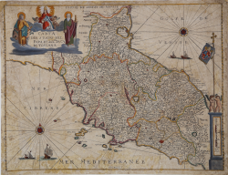
A rare map based on Giovanni Antonio Magini’s, published for the first time in 1620, and afterwards copied by Hondius (1636) and Janssonius (1647).
Todeschi took inspiration especially from the scond one, copying a French edition, as the names on the map suggest.
Copper engraving, a repaired map, light abrasions, in good condition.
|
F. Ronca e A. Sorbini (a cura di) "Le antiche terre del Ducato di Spoleto", p. 100, 36.
|
Pietro TODESCHI
|
F. Ronca e A. Sorbini (a cura di) "Le antiche terre del Ducato di Spoleto", p. 100, 36.
|
Pietro TODESCHI