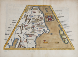
Ta. Superioris Indiae et Tartariae Maioris Laurent FRIES Code: S39558 Measures: 455 x 300 mm Year: 1522 ca. Printed: Strasbourg Price €2,800.00 Quick view View Details
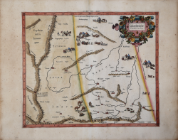
Asiae VIII Tab. Gerard MERCATOR (Kremer) Code: S10144 Measures: 410 x 350 mm Year: 1578 ca. Printed: Amsterdam Price €350.00 Quick view View Details
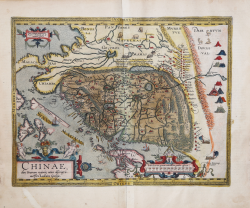
Chinae olim Sinarum Regionis, Novis Descriptio Abraham ORTELIUS Code: S46055 Measures: 475 x 370 mm Year: 1584 Printed: Antwerpen Price €4,800.00 Quick view View Details
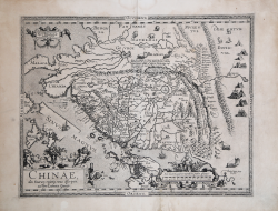
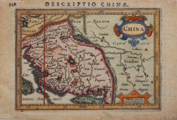
Chinae, olim Sinarum regionis, nova Descriptio Abraham ORTELIUS Code: S46071 Measures: 470 x 370 mm Year: 1584 ca. Printed: Antwerpen Price €4,000.00 Quick view View Details
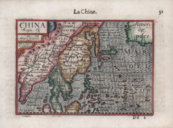
China Regio Asie Barent LANGENES Code: S50632 Measures: 125 x 90 mm Year: 1598 ca. Printed: Amsterdam Price €300.00 Quick view View Details
China Jodocus HONDIUS Jr. Code: ms4003 Measures: 135 x 100 mm Year: 1616 ca. Printed: Amsterdam Price €280.00 Quick view View Details
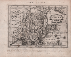
China Johannes JANSSONIUS Code: S48189 Measures: 192 x 135 mm Year: 1628 ca. Printed: Amsterdam Price €300.00 Quick view View Details
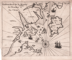
Embouchure de la Riviere de Chincheo à la Chine Seyger van Rechteren Code: S46176 Measures: 200 x 160 mm Year: 1639 ca. Printed: Paris Price €180.00 Quick view View Details
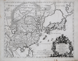
Il Regno della China detto presentemente Catay e Magin... Giacomo CANTELLI Code: S43965 Measures: 550 x 440 mm Year: 1682 Printed: Rome Price €1,300.00 Quick view View Details
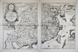
[Complete Set of Coronelli's maps of China] Vincenzo CORONELLI Code: S45268 Measures: 620 x 460 mm Year: 1688 ca. Printed: Venice Price €12,500.00 Quick view View Details
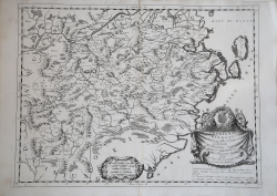
Chekiang, e Kiangsi, Provincie della China, dedicate... Vincenzo CORONELLI Code: S35971 Measures: 695 x 500 mm Year: 1690 ca. Printed: Venice Price €700.00 Quick view View Details
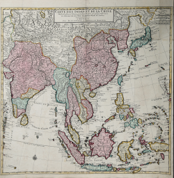
Carte des Indes et de la Chine Guillaulme DE L'ISLE Code: S39539 Measures: 635 x 635 mm Year: 1720 Printed: Amsterdam Price €850.00 Quick view View Details
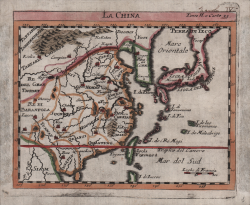
La China Guillaulme DE L'ISLE Code: S46177 Measures: 180 x 145 mm Year: 1720 Printed: Venice Price €225.00 Quick view View Details
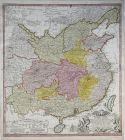
Regni Sinae vel Sinae Propriae Mappa et Descriptio Geographica… Eredi Johannes Baptiste HOMANN Code: S40070 Measures: 535 x 590 mm Year: 1730 ca. Printed: Nurnberg Price €575.00 Quick view View Details
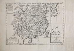
L'Impero della China Per uso della Storia Generale de' Viaggi Jacques Nicolas BELLIN Code: S46171 Measures: 395 x 285 mm Year: 1748 ca. Printed: Venice Price €350.00 Quick view View Details
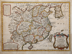
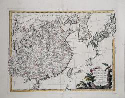
L'Empire de la Chine Jacques Nicolas BELLIN Code: S43961 Measures: 420 x 320 mm Year: 1748 Printed: Paris Price €325.00 Quick view View Details
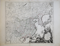
L'Empire De La Chine, Avec La Tartrie Chinoise d'Apres l'Atlas Chinois Francesco & Paolo SANTINI Code: S35711 Measures: 686 x 515 mm Year: 1779 Printed: Venice Price €450.00 Quick view View Details
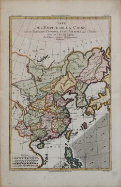
Carte de l'Empire de la Chine, de la Tartarie Chinoise, et du... Rigobert BONNE Code: S36556 Measures: 230 x 3465 mm Year: 1780 Printed: Paris Price €200.00 Quick view View Details
Impero della China colle Isole del Giappone Antonio ZATTA Code: ms4139 Measures: 425 x 330 mm Year: 1784 ca. Printed: Venice Price €500.00 Quick view View Details
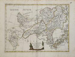
La Tartaria Chinese Vincenzo PAZZINI CARLI Code: AS12901 Measures: 315 x 240 mm Year: 1796 Printed: Siene Price €225.00 Quick view View Details