| Reference: | MS6345 |
| Author | Jan Huygen van LINSCHOTEN |
| Year: | 1638 ca. |
| Zone: | Title Page |
| Printed: | Amsterdam |
| Measures: | 180 x 120 mm |
| Reference: | MS6345 |
| Author | Jan Huygen van LINSCHOTEN |
| Year: | 1638 ca. |
| Zone: | Title Page |
| Printed: | Amsterdam |
| Measures: | 180 x 120 mm |
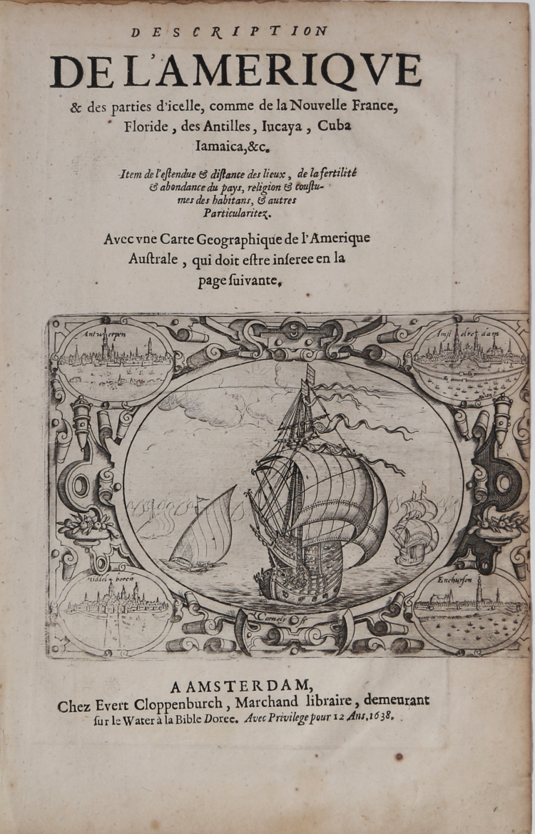
Title page of the famous Itinerario, voyage ofte schipvaert van J.H. van Linschoten naar Oost ofte Portugaels Indien. This plate appeared in Linschoten's book in 1596, once he came back from the Indies.
The engraver for this map was Baptista van Doetechum. Published by Cloppenburgh in 1638.
Trimmed al the right edge, otherwise good conditions.
|
Schilder, Gunter, Monumenta Cartographica Neerlandica, vol VII.
|
Jan Huygen van LINSCHOTEN (Haarlem, ca. 1563 - Enkhuizen 1611)
|
Dutch Protestant merchant, traveller and historian and geographer. He spent five years in Goa. Back in Holland, Van Linschoten sold his travel report to the Amsterdam publisher Cornelis Claesz, who published it in 1596 in a book that was beautifully illustrated with prints and maps. The Itinerario is more than a travel report: next to the account of his wanderings in the waters of the Azores, Portugal and the islands of what is now Indonesia, two further texts by Van Linschoten have been included in the volume. These are the Beschryvinghe van de gantsche custe van Guinea (Description of the entire coast of Guinee) and the Reys-gheschrift vande navigatien der Portugaloysers in Orienten (travel report on the navigations of the Portuguese in the East). The significance of this first Dutch compilation on India is primarily to be found in the valuable sailing instructions it contains: nautical data on currents, depths, islands and sandbanks, information sea captains could not do without if they wanted to navigate safely.
|
|
Schilder, Gunter, Monumenta Cartographica Neerlandica, vol VII.
|
Jan Huygen van LINSCHOTEN (Haarlem, ca. 1563 - Enkhuizen 1611)
|
Dutch Protestant merchant, traveller and historian and geographer. He spent five years in Goa. Back in Holland, Van Linschoten sold his travel report to the Amsterdam publisher Cornelis Claesz, who published it in 1596 in a book that was beautifully illustrated with prints and maps. The Itinerario is more than a travel report: next to the account of his wanderings in the waters of the Azores, Portugal and the islands of what is now Indonesia, two further texts by Van Linschoten have been included in the volume. These are the Beschryvinghe van de gantsche custe van Guinea (Description of the entire coast of Guinee) and the Reys-gheschrift vande navigatien der Portugaloysers in Orienten (travel report on the navigations of the Portuguese in the East). The significance of this first Dutch compilation on India is primarily to be found in the valuable sailing instructions it contains: nautical data on currents, depths, islands and sandbanks, information sea captains could not do without if they wanted to navigate safely.
|