

| Reference: | s29523 |
| Author | Richard BLOME |
| Year: | 1686 |
| Zone: | Horology |
| Printed: | London |
| Measures: | 240 x 390 mm |


| Reference: | s29523 |
| Author | Richard BLOME |
| Year: | 1686 |
| Zone: | Horology |
| Printed: | London |
| Measures: | 240 x 390 mm |
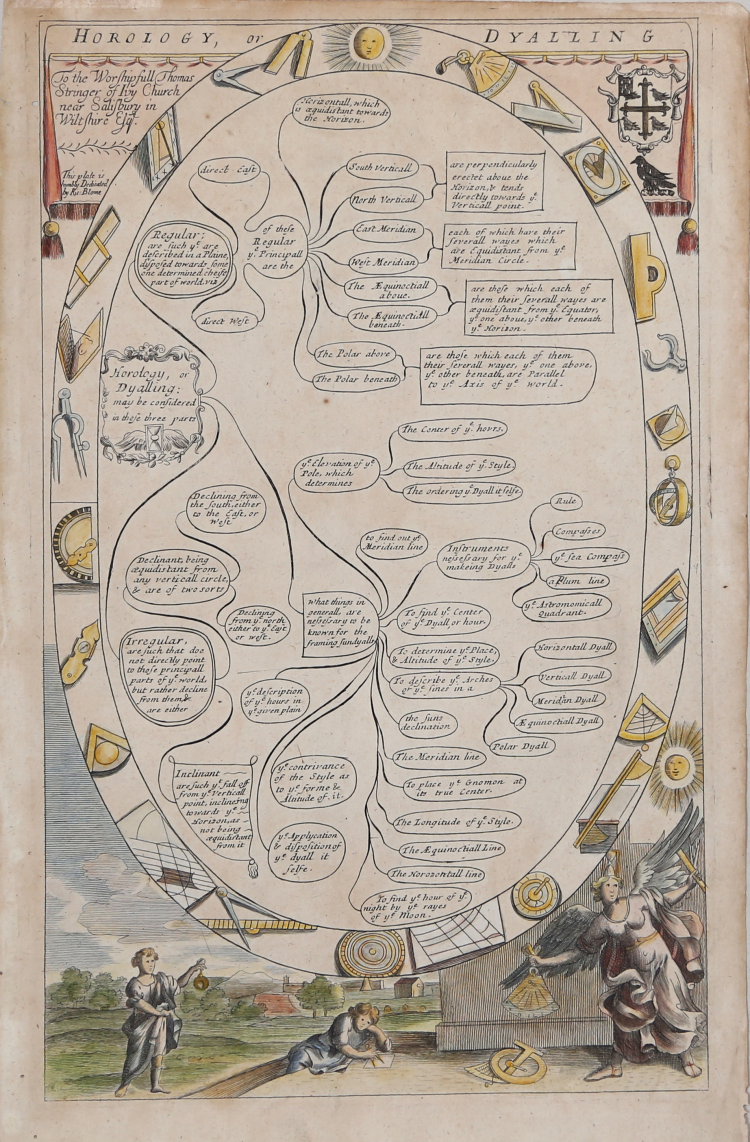
Taken from 'The Gentlemans Recreation in Three Parts' by Richard Blome, London: S. Roycroft, 1686.
Large oval with inscriptions explaining the various parts of the art of horology; below, two figures and an angel with compasses, quadrant, and other measuring instruments.
Copper engraving, hand-coloured, in very good conditions.
|
Richard Blome (1641-1705) was an English publisher and bookseller who flourished from about 1670 to 1705. He published two series of English county maps. The large series appeared in Blome’s Britannia, or a Geographical Description of the Kingdomes of England, Scotland and Ireland, with each map measuring approximately 300 x 250mm. The smaller series, with the maps approximately 240 x 180mm, were published in Blome’s Speed’s Maps Epitomiz’d: or the Maps of the Counties of England. On Blome’s death, the plates from the smaller atlas were purchased by Thomas Taylor, who revised the plates before reprinting them in his atlas England Exactly Described, published from 1715 onwards. Still later, the plates were re- published by Thomas Bakewell.
Blome has traditionally been accused of plagiarism. There can be no doubt that Blome’s maps were not original, but they filled a void in the market, between the large expensive atlases of Speed, Blaeu and Jansson, and the pocket-sized “miniature Speed” volume.
The maps themselves are charming and often attractive, many having decorative coats of arms, ships and sea monsters. Dedications to local worthies and textual annotations add to the distinctive style of these uncommon maps.
Blome also issued a world atlas, the Geographical Description of the Four Parts of the World, in 1670, which was re-issued as the Cosmography and Geography, in 1682 and 1693. The maps from this atlas were Anglicized copies of Nicolas Sanson’s work. Blome also issued a number of Bible maps, usually after Visscher.
|
|
Richard Blome (1641-1705) was an English publisher and bookseller who flourished from about 1670 to 1705. He published two series of English county maps. The large series appeared in Blome’s Britannia, or a Geographical Description of the Kingdomes of England, Scotland and Ireland, with each map measuring approximately 300 x 250mm. The smaller series, with the maps approximately 240 x 180mm, were published in Blome’s Speed’s Maps Epitomiz’d: or the Maps of the Counties of England. On Blome’s death, the plates from the smaller atlas were purchased by Thomas Taylor, who revised the plates before reprinting them in his atlas England Exactly Described, published from 1715 onwards. Still later, the plates were re- published by Thomas Bakewell.
Blome has traditionally been accused of plagiarism. There can be no doubt that Blome’s maps were not original, but they filled a void in the market, between the large expensive atlases of Speed, Blaeu and Jansson, and the pocket-sized “miniature Speed” volume.
The maps themselves are charming and often attractive, many having decorative coats of arms, ships and sea monsters. Dedications to local worthies and textual annotations add to the distinctive style of these uncommon maps.
Blome also issued a world atlas, the Geographical Description of the Four Parts of the World, in 1670, which was re-issued as the Cosmography and Geography, in 1682 and 1693. The maps from this atlas were Anglicized copies of Nicolas Sanson’s work. Blome also issued a number of Bible maps, usually after Visscher.
|