

| Reference: | S50047 |
| Author | Jacques Nicolas BELLIN |
| Year: | 1751 ca. |
| Zone: | Comoros Islands |
| Printed: | Venice |
| Measures: | 250 x 180 mm |


| Reference: | S50047 |
| Author | Jacques Nicolas BELLIN |
| Year: | 1751 ca. |
| Zone: | Comoros Islands |
| Printed: | Venice |
| Measures: | 250 x 180 mm |
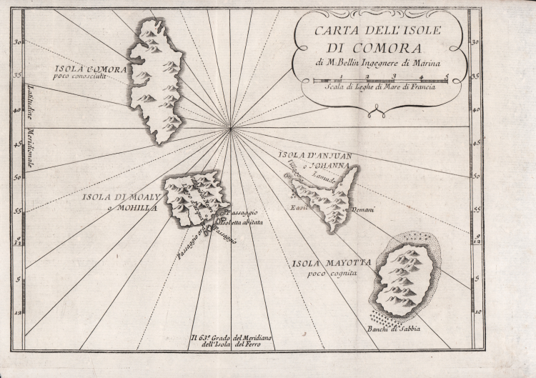
Italian edition of Jacques Nicolas Bellin's map of the Comoros Islands.
It is published in the translation of the Histoire generale des voyages by Antonine de Prevost d'Exile, printed in Venice appresso Pietro Valvasense a San Giovanni Nuovo, under the title of Storia generale de’ viaggi. O nuova raccolta di tutte le relazioni de’ viaggi per mare, e per terra, state pubblicate fino al presente nelle diverse lingue di tutte le Nazioni cognite, 1751-64.
Jacques Nicolas Bellin (1703 - March 21, 1772) was born in Paris. He was a hydrographer for the French Hydrographic Office, a member of the Académie de Marine and the Royal Society of London. In his 50-year career he produced a large number of charts of special interest to the Ministère de la Marine.
Etching, usual editorial folds, in very good condition
Jacques Nicolas BELLIN (1703 - 1772)
|
Jacques-Nicolas Bellin (1703 - 1772) was one of the most important cartographers of the 18th century.
With a career spanning some 50 years, Bellin is best understood as transitional mapmaker spanning the gap
between 18th and early 19th century cartographic styles. His long career as Hydrographer and Ingénieur
Hydrographe at the French Dépôt des cartes et plans de la Marine resulted in hundreds of high quality
nautical charts of practically everywhere in the world. Bellin's work focuses on function and accuracy
tending in the process to be less decorative than the earlier 17th and 18th century cartographic work. In
addition to numerous maps and charts published during his lifetime, many of Bellin's maps were updated
(or not) and published posthumously. He was succeeded as Ingénieur Hydrographe by his student, also a prolific and influential cartographer, Rigobert Bonne.
|