- New
| Reference: | S48871 |
| Author | Jean Baptiste NOLIN |
| Year: | 1742 |
| Zone: | Europe |
| Printed: | Paris |
| Measures: | 600 x 460 mm |
| Reference: | S48871 |
| Author | Jean Baptiste NOLIN |
| Year: | 1742 |
| Zone: | Europe |
| Printed: | Paris |
| Measures: | 600 x 460 mm |
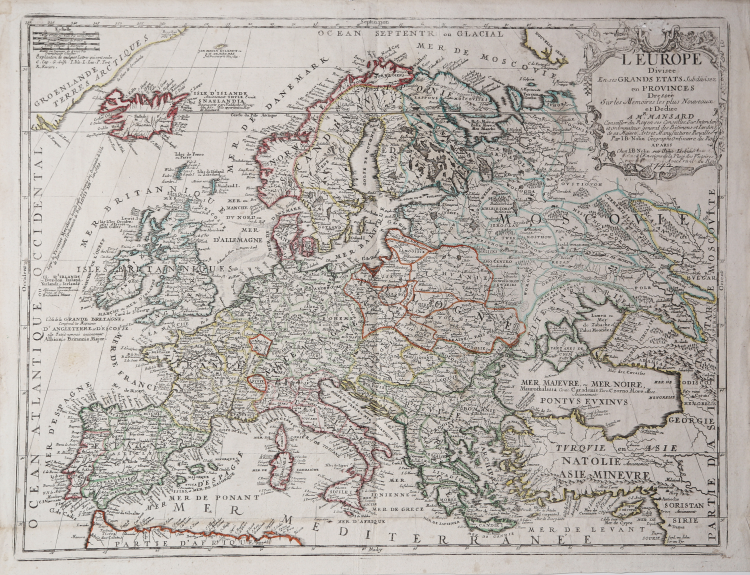
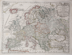
Beautiful map of Europe, first printed in 1703 by Jean Baptiste Nolin.
Example of the second state with the correct date in 1742, printed by his son Jean Baptiste Nolin II.
The Nolin printing house was founded by Jean Baptiste Nolin (c. 1657-1708), who took up the family publishing business in Paris, Rue St. Jacques, where his father had an engraving workshop. A pupil of Francois de Poilly, towards the end of the century he began to enjoy a certain notoriety until he became “graveur ordinaire du roi, marchand de tailles douces” and, in 1694, “géographe du duc d'Orléans,” brother of King Louis XIV. Upon the duke's death in 1701, he assumed the title of “geographe du Roy.” His career evolved somewhat after meeting Abbot Vincenzo Maria Coronelli, who entrusted him with the engraving of his large celestial globe of 28 spindles.
Nolin, not being a true geographer, had difficulty making original maps and therefore drew on models from other geographers. Many of his works were based on engravings by Coronelli - some made in collaboration - and another French cartographer, Jean Nicolas de Tralage known as Tillemon.
Another source for his maps was information coming from wars in Europe, to which he had access by being “geographe du Roy.” In 1701 Nolin himself published Le Theatre de la Guerre en Italie, a collection consisting of initial 18 maps that was well soon reprinted and updated.
Copperplate engraving, origina coloring of the outlines, in good condition.
Jean Baptiste NOLIN (circa 1657 - 1708)
|
Jean-Baptiste Nolin (ca. 1657-1708) was a French engraver who worked at the turn of the eighteenth century. Initially trained by Francois de Poilly, his artistic skills caught the eye of Vincenzo Coronelli when the latter was working in France. Coronelli encouraged the young Nolin to engrave his own maps, which he began to do.
Whereas Nolin was a skilled engraver, he was not an original geographer. He also had a flair for business, adopting monikers like the Geographer to the Duke of Orelans and Engerver to King XIV. He, like many of his contemporaries, borrowed liberally from existing maps. In Nolin’s case, he depended especially on the works of Coronelli and Jean-Nicholas de Tralage, the Sieur de Tillemon. This practice eventually caught Nolin in one of the largest geography scandals of the eighteenth century.
In 1700, Nolin published a large world map which was seen by Claude Delisle, father of the premier mapmaker of his age, Guillaume Delisle. Claude recognized Nolin’s map as being based in part on his son’s work. Guillaume had been working on a manuscript globe for Louis Boucherat, the chancellor of France, with exclusive information about the shape of California and the mouth of the Mississippi River. This information was printed on Nolin’s map. The court ruled in the Delisles’ favor after six years. Nolin had to stop producing that map, but he continued to make others.
Calling Nolin a plagiarist is unfair, as he was engaged in a practice that practically every geographer adopted at the time. Sources were few and copyright laws weak or nonexistent. Nolin’s maps are engraved with considerable skill and are aesthetically engaging.
Nolin’s son, also Jean-Baptiste (1686-1762), continued his father’s business.
|