

| Reference: | S42869 |
| Author | Litografia Guitti |
| Year: | 1850 ca. |
| Zone: | Ferrara |
| Measures: | 555 x 415 mm |


| Reference: | S42869 |
| Author | Litografia Guitti |
| Year: | 1850 ca. |
| Zone: | Ferrara |
| Measures: | 555 x 415 mm |
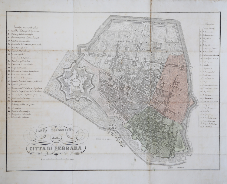
INEDITED map of Ferrara published by Litografia Guitti, towards the middle of the nineteenth century.
The plan, made in lithography, is completed by two handwritten legends, with references - always in ink - inside the same. On the left side there is an alphabetical legend (A-c) of 28 references to the "Remarkable places" of the city; on the right side another numerical legend (1-29) describes the "Churches". The work is not described in the bibliography. and probably, as the manuscript part shows, was never published.
The city is divided into 4 districts, marked by watercolor.
There is little or no information about Litografia Guitti, except for the fact that he printed his works in Ferrara.
Beautiful example, with several times folded, light oxidation, otherwise in excellent condition. Very rare.
Litografia Guitti(attiva a Ferrara nel XIX secolo)
Litografia Guitti(attiva a Ferrara nel XIX secolo)