

| Reference: | S43513 |
| Author | Jean-Baptiste POIRSON |
| Year: | 1805 |
| Zone: | France |
| Printed: | Paris |
| Measures: | 1426 x 1060 mm |


| Reference: | S43513 |
| Author | Jean-Baptiste POIRSON |
| Year: | 1805 |
| Zone: | France |
| Printed: | Paris |
| Measures: | 1426 x 1060 mm |
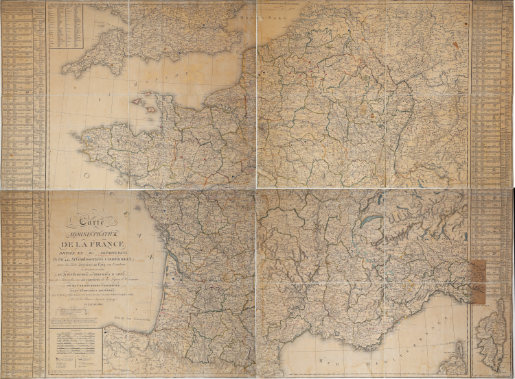
Very rare large wall map of France, printed on four sheets of laid paper (size 713x530 mm each, for a total - when joined - of 1426x1060 mm) laid down to coeval cloth, several times folded into a case.
Depicts France in its administrative division under the rule of Napoleon Bonaparte.
The departmental administrative district was created by the law of December 22, 1789. The constitution of Dec. 13, 1799, confirmed the division of European territory into departments and municipal districts. A veritable "administrative constitution," it organized the territory and its management under the figure of the Prefect: appointed by the First Consul (and later by the Emperor), he was "solely responsible for the administration" of the department and proved to be a decisive factor in the application of internal policy. He issued decrees, had the police at his disposal, managed expenditures, ensured the collection of taxes and the recruitment of troops.
Poirson's map depicts France in 1805, divided into 110 departments. In 1812, French departments became 134, including 47 "foreign" departments.
The map is of great rarity; we found no trace of it in the BNF collection, which has later ones.
Jean-Baptiste Poirson was a French engineer, globe maker, geographer and cartographer active in the late 18th and early 19th centuries. Poirson, having completed his mathematical studies, took a position with the map publisher Edme Mentelle (1730 - 1815). Beginning around 1790, maps began to appear under Poirson's imprint.. Among his most significant works are the maps associated with the French edition of Alexander von Humboldt's Atlas Geographique Et Physique Du Royaume De La Nouvelle-Espagne. He also worked with Conrad Malte-Brun (1775 - 1826) and François-Raymond-Joseph de Pons (1751 - 1812).
Jean-Baptiste POIRSON (1760 - 1831)
|
Jean-Baptiste Poirson (March 6, 1761 – February 12, 1831) was a French engineer, globe-maker, geographer, and cartographer active in the late 18th and early 19th centuries. Poirson was born in Vrécourt (Vosages), France, the son of the town's master blacksmith, Pierre Poirson. Completing his studies in mathematics, Poirson took a position with the map publisher Edme Mentelle (1730 - 1815). From about 1790, maps begin appearing under the Poirson imprint. Having attained some recognition for correcting the work of earlier geographers, Porison was part of a team that collaborated on a large terrestrial globe for the instruction of the Dauphin. After 1803, he was again called on to produce an updated globe, this time for Napoleon Boneparte (this globe is preserved at Fontainebleau). Among his more significant works are the maps associated with the French edition of Alexander von Humboldt's Atlas Geographique Et Physique Du Royaume De La Nouvelle-Espagne. He also worked with Conrad Malte-Brun (1775 - 1826) and François-Raymond-Joseph de Pons (1751 - 1812). In 1825, Poirson and his wife settled in Valence-en-Brie (Seine-et-Marn), purchasing a house on the main street, today's Rue André-Taboulet. He died there in1831 and was survived by his son, the famous French playwright Charles-Gaspard Delestre-Poirson (1790 – 1859).
|