

| Reference: | S39529 |
| Author | Reiner & Joshua OTTENS |
| Year: | 1730 ca. |
| Zone: | Poland, Lithuania |
| Printed: | Amsterdam |
| Measures: | 610 x 470 mm |


| Reference: | S39529 |
| Author | Reiner & Joshua OTTENS |
| Year: | 1730 ca. |
| Zone: | Poland, Lithuania |
| Printed: | Amsterdam |
| Measures: | 610 x 470 mm |
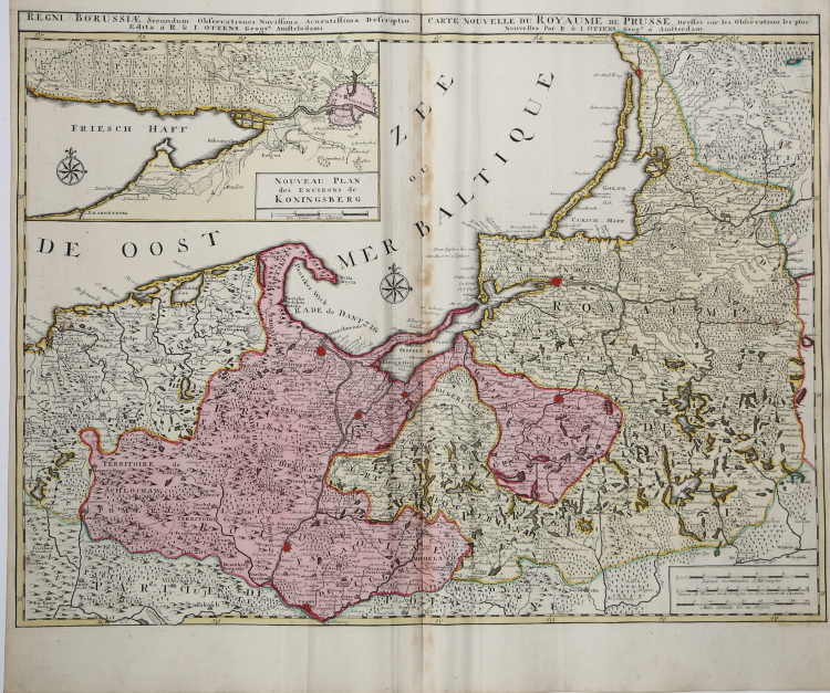
Scarce map of the north Part of Poland, Kaliningrad, and northwestern Lithuania, extending to Memel (Klaipeda).
The map shows significant details in the regions shown, extending as far south as Torun, Wizna, Lomza, Bydgoszcz and Pila.
From Atlas minor sive geographia compendiosa in qua orbid terrarum paucis attamen novissimis tablulis ostenditur - Atlas nouveau contenant toutes les parties du monde o๠sont exactement remarquées les empires, monarchies, royaumes,états, républiques, &c. Amsterdam, R. & J. Ottens.
A very good example with fine original colour. Traces of glue to the central fold.
|
The family business of print and map selling was founded by Joachim Ottens but the active period of map publishing was concentrated in the years between 1720 and 1750 when the brothers, Reiner and Joshua, produced enormous collections of maps, some as large as 15 volumes.
These, including copies of practically all maps available at the time, were made up to order and were magnificently coloured. Besides these specially prepared collections they also issued single-volume atlases with varying contents as well as pocket atlases.
|
|
The family business of print and map selling was founded by Joachim Ottens but the active period of map publishing was concentrated in the years between 1720 and 1750 when the brothers, Reiner and Joshua, produced enormous collections of maps, some as large as 15 volumes.
These, including copies of practically all maps available at the time, were made up to order and were magnificently coloured. Besides these specially prepared collections they also issued single-volume atlases with varying contents as well as pocket atlases.
|