| Reference: | S49087 |
| Author | Stanislao STUCCHI |
| Year: | 1848 |
| Zone: | Italy |
| Printed: | Milan |
| Measures: | 1000 x 1200 mm |
| Reference: | S49087 |
| Author | Stanislao STUCCHI |
| Year: | 1848 |
| Zone: | Italy |
| Printed: | Milan |
| Measures: | 1000 x 1200 mm |
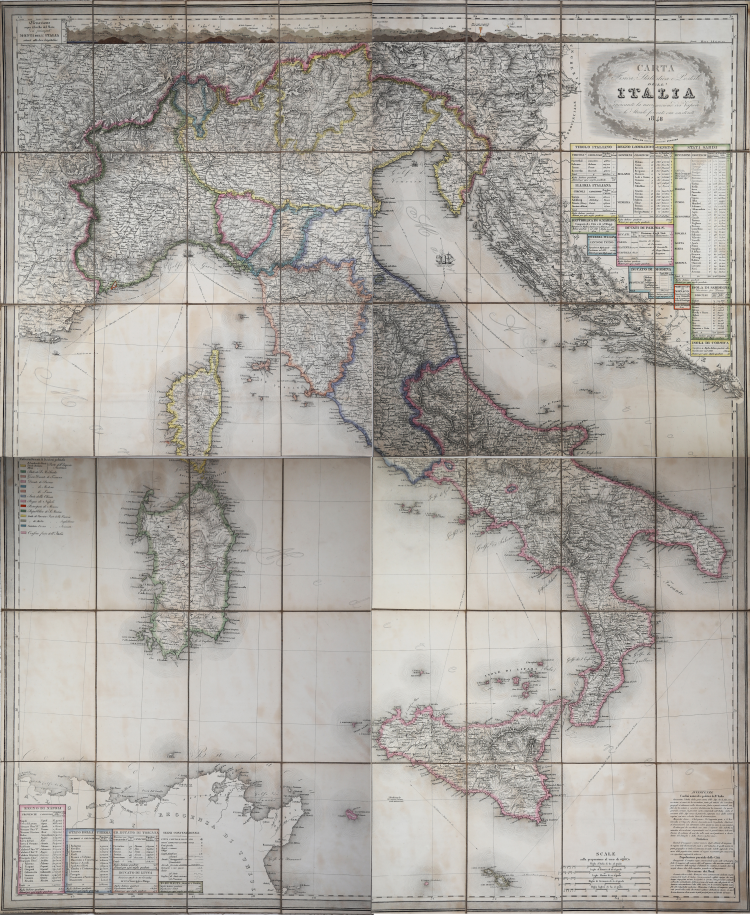
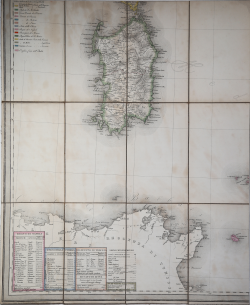
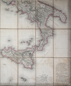
Rare folding postal map, divided into 48 sections mounted on cloth. The political division is outlined in watercolor, at the top the sequence of mountains of Italy displayed in their longitude, cartouche with titles and at the bottom legend with various data.
The geography of Italy in the mid-19th century is depicted in this detailed postal map. In addition to depicting the mountainous topography of the country with shaded relief, it also shows the location of post offices, postal routes, by rail and by steamboat. The table also shows ferry routes between various Italian cities, with distances and times of passage.
Stanislao Stucchi (Active in the first half of the 19th century) was a Milanese engraver, geographer and publisher. Between 1822 and 1827, he produced a Grande atlante di geografia moderna with 26 large-format maps tastefully engraved by Giuseppe Pezze and himself. Around 1820 he began publishing in fascicles, differentiated according to the print run “in black” or “in color,” the “Raccolta di scene teatrali eseguite o disegnate dai più celebri pittori scenici in Milano”.
Etching with contemporary outline coloring, light foxing, otherwise excellent condition.
Stanislao STUCCHI (Attivo nella prima metà del XIX sec.)
|
Engraver, geographer and publisher in Milan. Between 1822 and 1827, he achieved a great atlas of modern geography with 26 large format maps engraved by Giuseppe Pezze and himself. Around 1820 lui began to publish in installments, differentiated according to the edition "black" or "color" t"Raccolta di scene teatrali realizzati o disegnati dai più famosi pittori scenici di Milano". The Publications continued until completion of the program (1829 - 1830): 300 tables almost all related to specific events in the present or of the immediate past. It was a selection, not a complete documentation, and without a chronological order.
|