

| Reference: | S42889 |
| Author | Anonimo |
| Year: | 1780 ca. |
| Zone: | Genova |
| Measures: | 420 x 300 mm |


| Reference: | S42889 |
| Author | Anonimo |
| Year: | 1780 ca. |
| Zone: | Genova |
| Measures: | 420 x 300 mm |
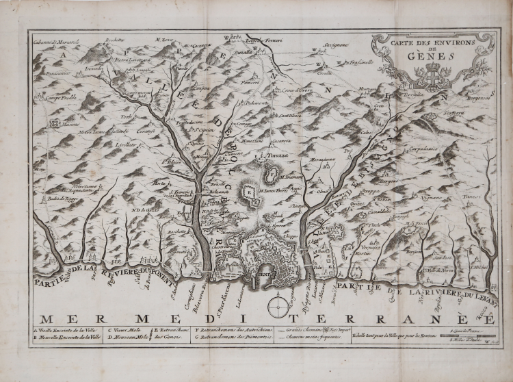
Anonymous work, without printing details. Bottom right is the signature of the plate engraver "W. fecit".
Map of the central part of Liguria, depicting the environs of Genoa; extending east to Recco, and west to include Voltri.
Etching, circa 1780/90, impressed on contemporary laid paper, folded several times and thus with paper creases, in excellent condition.
We have not been able to find any further information on this map of Liguria, probably taken from a book. An example of the map is preserved at the BNF (where the author is not indicated):
https://catalogue.bnf.fr/ark:/12148/cb445009998
Rare.
Anonimo
Anonimo