

| Reference: | S46334 |
| Author | Gerard & Rudolf Wetstein |
| Year: | 1728 |
| Zone: | Mediterranean Sea |
| Printed: | Amsterdam |
| Measures: | 715 x 365 mm |


| Reference: | S46334 |
| Author | Gerard & Rudolf Wetstein |
| Year: | 1728 |
| Zone: | Mediterranean Sea |
| Printed: | Amsterdam |
| Measures: | 715 x 365 mm |
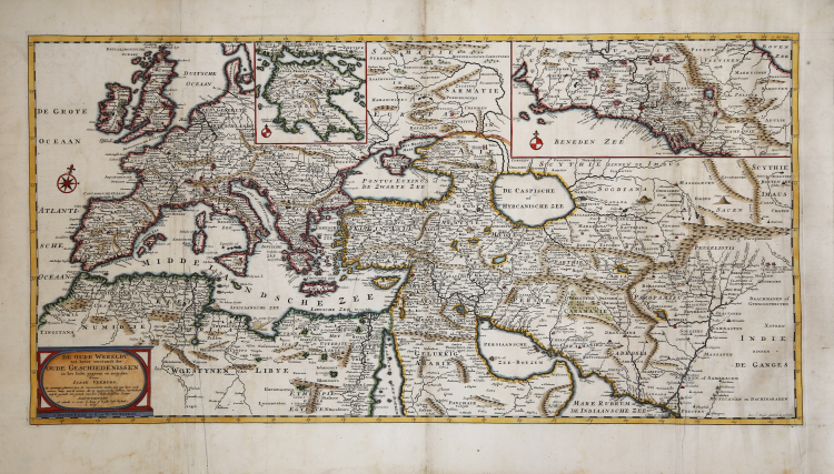
An unusual map of the Old World that covers the Mediterranean Sea.
Bottom left of the title cartouche with an explanation of abbreviations used at the bottom. Top right an inset with a map of part of Italy. Above, left of center, an inset with a map of the Peloponnese. The map has a degree division along the edges. The sheet is beautifully engraved and filled with ancient place names. Printed on two joined sheets. Marked top right: 1. part. page 1.
The map is taken from the Algemene kerkelyke en wereldlyke geschiedenissen des bekenden aard-kloots by Sugars Geerlof and Isaac Verburg, published in 5 volumes. Amsterdam: Gerard and Rudolf Wetstein, 1721-1728.
Copperplate with fine later hand colour, very good condition.
Gerard & Rudolf Wetstein (Amsterdam 1680 - 1755)
|
Bookseller, in Amsterdam 1701-36. Partner of his brother Rudolf Wetstein. From 1727 the brothers were in partnership with William Smith.
|
Gerard & Rudolf Wetstein (Amsterdam 1680 - 1755)
|
Bookseller, in Amsterdam 1701-36. Partner of his brother Rudolf Wetstein. From 1727 the brothers were in partnership with William Smith.
|