

| Reference: | S11250 |
| Author | C. BROWNE |
| Year: | 1712 |
| Zone: | Mediterranean Sea |
| Printed: | London |
| Measures: | 235 x 165 mm |


| Reference: | S11250 |
| Author | C. BROWNE |
| Year: | 1712 |
| Zone: | Mediterranean Sea |
| Printed: | London |
| Measures: | 235 x 165 mm |
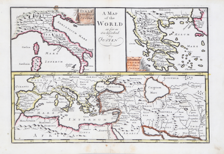
Chart of the mediterranean sea with two carouches containing Italy and Greece. Copperplate, contemporary outline colour, in excellent condition. Very rare.
|
Zacharakis C. G. "A Catalogue of Printed Maps of Greece 1477 - 1800" (2009), n. 738
|
C. BROWNE
|
Zacharakis C. G. "A Catalogue of Printed Maps of Greece 1477 - 1800" (2009), n. 738
|
C. BROWNE