

| Reference: | VR70GE |
| Author | Gabriel BODENEHR |
| Year: | 1704 |
| Zone: | Mediterranean Sea |
| Printed: | Augsburg |
| Measures: | 235 x 160 mm |


| Reference: | VR70GE |
| Author | Gabriel BODENEHR |
| Year: | 1704 |
| Zone: | Mediterranean Sea |
| Printed: | Augsburg |
| Measures: | 235 x 160 mm |
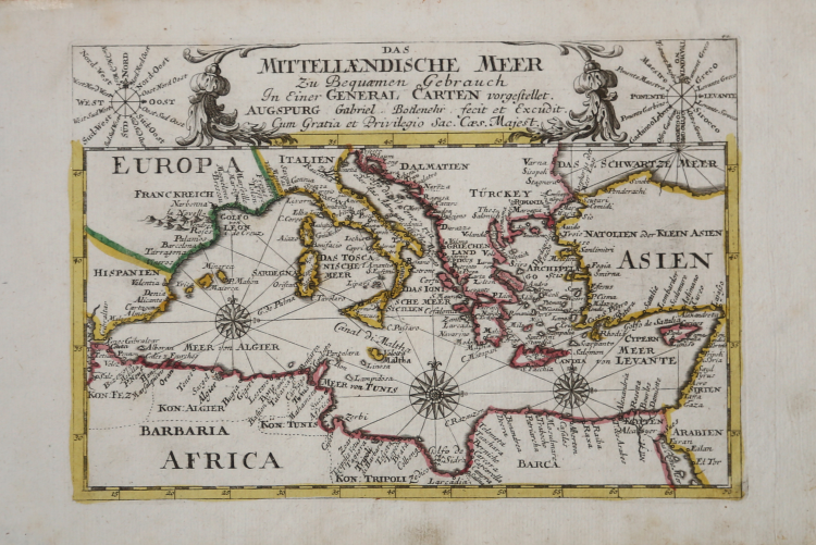
Very decorative copper-engraved map from Bodenehr's "Atlas curieux" published in Augsburg.
Shows the Mediterranean Sea with many place names. Decorated with an ornamental title-cartouche, flanked by 2 wind roses and three compass roses within the map. Rare to find in such good condition.
|
Gabriel Bodenher was a famous engraver and publisher.In 1716 purchased the plates from Stridbeck and then republished many of his works. In 1704 he published "Atlas Curieux oder Compendieuser und Neuer Atlas".
|
|
Gabriel Bodenher was a famous engraver and publisher.In 1716 purchased the plates from Stridbeck and then republished many of his works. In 1704 he published "Atlas Curieux oder Compendieuser und Neuer Atlas".
|