

| Reference: | VR90 |
| Author | Joseph ROUX |
| Year: | 1764 |
| Zone: | Tyrrenian Sea |
| Printed: | Marsiglia |
| Measures: | 815 x 590 mm |


| Reference: | VR90 |
| Author | Joseph ROUX |
| Year: | 1764 |
| Zone: | Tyrrenian Sea |
| Printed: | Marsiglia |
| Measures: | 815 x 590 mm |
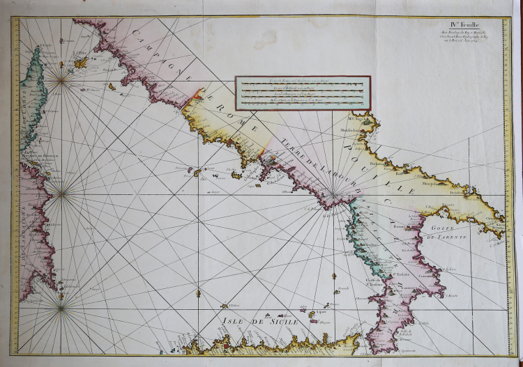
IV.e Feuille / Avec Privilege du Roy à Marseille / Chez Joseph Roux Hydrographe du Roy / sur le Porte à S.t Jean 1764.
Taken from "Carte de la Mer Mediterranee en Douze Feuilles. Dediée a M.r le Duc de Choiseul Colonel General des Suisses et Grisons, Ministre de la Guerre et de la Marine. Par son très humble Serviteur Joseph Roux Hydrographe du Roy, sur le port a S. t. Jean, a Marseille. Avec Privilege du Roy", Marseille, 1764.
It represented the Tyrrhenian Sea, with central and southern Italy, Sicily, North Africa and the western part of Corsica and Sardinia. The map represents the sheet n. 4 of the big chart of the Mediterranean published in Marseilles, in twelve sheets, made by Joseph Roux in 1764. Was published in the form of atlas in 12 plates in which is represented the whole basin of the Mediterranean and the Sea of Marmara.
The work was dedicated to the Minister of War and Navy Duke of Choiseul. The cut of the charts, the relative scale of reduction taken, the type of symbols used, evidence of a direct derivation from the nautical atlas that Michelot and Bremond had built 50 years earlier. Perfect condition.
Joseph ROUX (Attivo nella seconda metà del XVIII sec.)
|
Joseph Roux was a Marseilles hydrographer who both published and as well manufactured and sold charts, navigating instruments and related nautical equipment.
At about the mid-century, he received the right to be called "Hidrographe du Roy," and in 1764 published a series of 12 charts of the Mediterranean; he simultaneously published this smaller format atlas of 65 harbor charts. Several editions followed until well into the 19th century, both in France and in Italy, all enlarged. Some were by Roux himself, some were pirated.
Sanderson, The Sea Chart, p. 91, calls this "a popular book," but few examples survive, and all editions are rare
|