

| Reference: | S44860 |
| Author | Johannes de Laet |
| Year: | 1630 ca. |
| Zone: | Mexico |
| Printed: | Amsterdam |
| Measures: | 360 x 280 mm |


| Reference: | S44860 |
| Author | Johannes de Laet |
| Year: | 1630 ca. |
| Zone: | Mexico |
| Printed: | Amsterdam |
| Measures: | 360 x 280 mm |
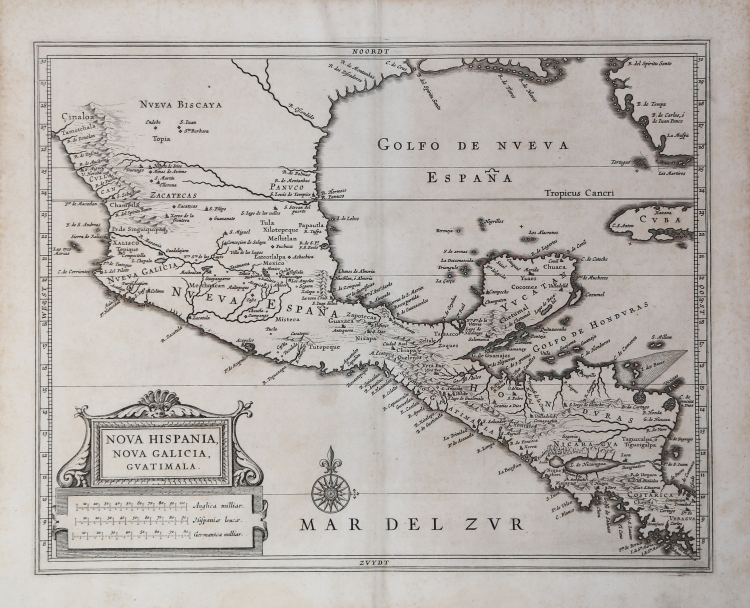
The map, which covers most of the viceroyalty of New Spain, is a milestone in the cartography of the Americas from the perspective of European colonizers. A surprisingly accurate political and geographical profile of the region between Costa Rica and the southwestern United States provides a detailed overview about a century after the final conquest of the Aztec empire.
Various place names identify Catholic missions, industrial cities, port cities, presidios, and the few remaining indigenous settlements. Volcanoes, the landing point of Ponce de Leon in Florida, and other geographical features are also indicated. It is possible that Spiritu Santo Bay is the mouth of the Mississippi River, although some scholars debate this claim.
The map was published in Leiden in 1630 as part of Johannes de Laet’s Nieuwe Wereldt often Beschrijvinghe van West-Indien (Description of the West Indies). The work was originally issued in 1625 and contained ten maps – this is from the slightly updated version that contained fourteen maps and an additional 100 pages of text, reflecting the increased interest of the Dutch in the New World.
Described by Philip Burden as “arguably the finest description of the Americas published during the seventeenth century,” the maps in de Laet’s work were based directly off the cartography of Hessel Gerritsz, considered by some to be the foremost mapmaker of the Dutch Golden Age of Cartography. Gerritsz was the exclusive cartographer for the Dutch East India Company and had access to some of the most up-to-date information available. His maps are generally only available in manuscript form and those published by de Laet are some of the few available to collectors today.
Johannes de Laet was no slouch, either, and he used meticulous research and contemporary sources when compiling his geographic data. As a director of the newly formed Dutch West India Company, the latest information from private correspondence, manuscripts, and other company secrets would have also been made available when compiling the maps.
Etching, very good condition. Rare.
Johannes de Laet(1581 - 1649
Johannes de Laet(1581 - 1649