

| Reference: | CO-400 |
| Author | Georg Louis le ROUGE |
| Year: | 1767 |
| Zone: | North Italy |
| Printed: | Paris |
| Measures: | 280 x 210 mm |


| Reference: | CO-400 |
| Author | Georg Louis le ROUGE |
| Year: | 1767 |
| Zone: | North Italy |
| Printed: | Paris |
| Measures: | 280 x 210 mm |
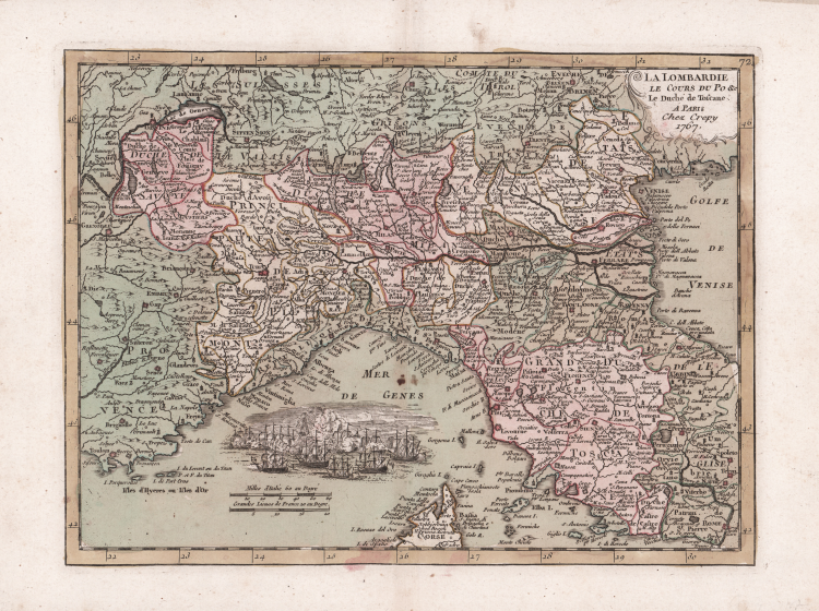
Carta geografica preparata per l’Introduction a la Geographie di Georg Louis Le Rouge, pubblicato a Parigi tra il 1747 ed il 1756, a "Paris, chez l'Auteur, Prault le fils, la Veuve Robinot, 1756".
L'opera, che l'autore definisce come "Atlas Nouveau Portatif à l'Usage des Militaires et du Voyageur', contiene 86 carte geografiche.
Questo esemplare è una ristampa dell’editore P. Crepy, con data 1767.
Le Rouge trascorse gran parte dei suoi quarant'anni di carriera traducendo varie opere dall'inglese al francese, e la sua influenza cartografica proveniva spesso da mappe inglesi. La sua esperienza come geometra e ingegnere in Germania lo rese un cartografo abile e prolifico e produsse migliaia di carte, mappe, atlanti e piani. Il suo lavoro spazia da vedute di giardini e piani di piccole città a enormi mappe di più continenti. Le Rouge accettò infine l'incarico di ingegnere geografico per Luigi XV, il re di Francia.
Incisione in rame, coloritura coeva, in ottimo stato di conservazione.
Georg Louis le ROUGE (1721-1790 circa)
|
A military engineer by profession, Le Rouge took up cartography and over a long period from about 1740 to 1780 produced many attractive works covering a wide range of subjects, including plans of fortifications, military campaigns, town plans as well as the more usual atlases and sea charts.
1741-62 Atlas General
1742 Recueil des cartes Nouvelles (including a reissue on reduced scale of Henry Popple’s map of America of 1733)
1748 Atlas Nouveau Portatif (4to)
1756,c.1767 re-issued
1755 Recueil des Plans de l’ Amerique(8vo)
1756 Introduction de Geographie
1758 Atlas Prussien
1759 recueil des villes ,portes d’ Angleterre (8vo)
1760 Topographie des Chemins d’ Angleterre (8vo)
1778 Atlas Ameriquain Septentrional
|