| Reference: | S1580 |
| Author | Giacomo GASTALDI |
| Year: | 1567 |
| Zone: | Apulia |
| Printed: | Venice |
| Measures: | 355 x 220 mm |
| Reference: | S1580 |
| Author | Giacomo GASTALDI |
| Year: | 1567 |
| Zone: | Apulia |
| Printed: | Venice |
| Measures: | 355 x 220 mm |
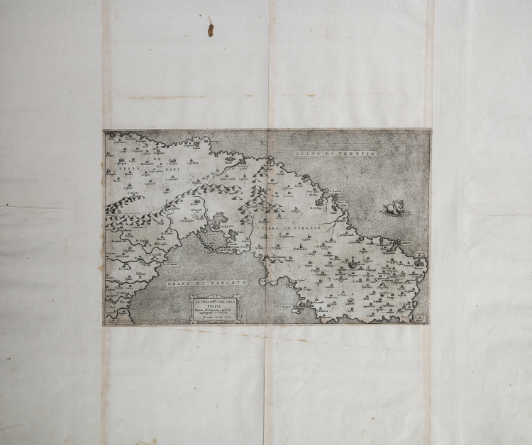
In the ornate cartouche in the lower center the title: LA DESCRIPTIONE DELA PUGLIA Opera di Giacomo gastaldo cosmografo in Venetia. Ferando bertelj 1567.
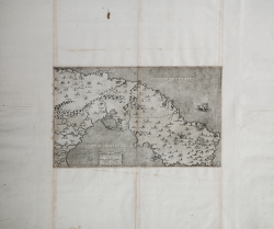
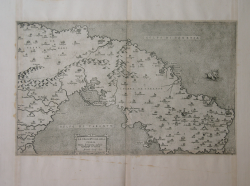
The Descriptione dela Puglia del Cosmografo Giacomo Gastaldi engraved by Ferrando Bertelli in Venice in 1567 represents the first printed map of Puglia and is one of Gastaldi's few works without a graduated margin and graphic scale. The map reproduces the southeastern part of Puglia, the Terra d'Otranto, and extends to the southern part of the Terra di Bari, including an eastern portion of Basilicata. The orography is rendered in mole cones with illumination from the east; careful hydrographic depiction. The only decorative element is the large sea monster in the Gulf of Venetia, the ancient name for today's Adriatic Sea. Published posthumously, a year after Gastaldi's death, it is believed to be based on materials prepared by the cartographer before the Il disegno della geografia moderna de tutta la provincia de la Italia of 1561.
“L’opera fu oggetto di un attento studio del Colamonico, che ritiene la carta una derivazione di un’edizione xilografica precedente (oggi andata perduta), e che i dati siano serviti parzialmente per la stesura della carta della penisola, poi utilizzata per correggere alcune inesattezze della carta regionale. Tale ipotesi viene ripresa e integrata da Almagià (1948), che sostiene che la carta è basata su materiali cartografici anteriori al 1557, poi tralasciati, e in seguito impiegati da Bertelli per la compilazione di questa tavola. La Puglia è una delle poche carte del Gastaldi che manca di graduazione ai margini e di scala grafica. La tavola fu modello per successive mappe della regione, a partire da quella che Abraham Ortelius inserisce nel Theatrum Orbis Therrarum del 1570. Un secondo stato della lastra, con una flotta spagnola di navi nel mare, è edito da Donato Rascicotti nel 1617” (cfr. Bifolco-Ronca, Cartografia e topografia italiana del XVI secolo, p. 2078).
“Interessante notare come nel suo saggio il Colamonico notasse la grande abbondanza di indicazioni corografiche evidenziando "come il tracciato della linea di confine fra la Terra di Bari e Terra d'Otranto costituisse «una vera e propria singolarità» per una precisa individuazione dei confini fra le due unità amministrative; una singolarità questa ancora più eccezionale perché soltanto alla fine del '500 nei disegni per regioni o per province dello Stigliola e del Magini sarebbe riapparso un «simile particolare cartografico». (Brancaccio 1991: 138). Dal punto di vista confinale è da notare come fra le località della Terra d'Otranto figuri Matera, il cui territorio, circa un secolo più tardi, nel 1663, verrà staccato dalla Puglia diventando parte integrante della Basilicata, della quale sarà capoluogo fino al 1806” (cfr. Bari e il suo mare dal Rinascimento al Novecento. La rappresentazione cartografica e le vedute della Terra di Bari, p. 46).
Giacomo Gastaldi (active between 1542 and 1565), a Piedmontese who worked in Venice and became the cosmographer of the Venetian Republic. Robert Karrow in his text on cartographers describes him as one of the leading figures of the entire 16th century, certainly the most important Italian cartographer of the 1500s. Although a very large number of maps were made under his direction, and thus assigned to him as author, it is often difficult to establish what actual role Gastaldi played in these creations. He practically signed almost none of his works; however, we frequently find his name in the title cartouche or dedicatory, demonstrating the importance of the role he played. The principal engraver of Gastaldi's maps was Fabio Licinio, while his works were edited and circulated by the main Venetian publishers -Pagano, Bertelli, Forlani etc. - first and later in Rome by Antonio Lafreri.
Etching and engraving, impressed on laid paper, trimmed to the platemark and with contemporary margins added, in very good condition. Example in the first state of two described in Bifolco-Ronca (Tav. 1050), before Donato Rascicotti's address. Iconic printed map on the region.
Bibliografia
Bifolco-Ronca, Cartografia e topografia italiana del XVI secolo, p. 2078, Tav. 1050 I/II; Almagià (1929): p. 32, tav. XXXVI; Colamonico (1930): p. 145; Karrow (1993): n. 30/105; Lago (2002): pp. 466-467, fig. 459; Tooley (1939): n. 114; Bari e il suo mare dal Rinascimento al Novecento. La rappresentazione cartografica e le vedute della Terra di Bari, p. 46.
Giacomo GASTALDI (1500 circa – 1565 circa)
|
Giacomo Gastaldi was born, according to the predicate that accompanies his signature on the card in Spain in 1544, Villafranca Piemonte (today the province of Turin), in the late fifteenth and early sixteenth century. Although counted among the greatest cartographers of the sixteenth century, the events of his life are unknown until 1539 when his name appears for the first time in a grant of privilege of printing a "perpetual almanac," now lost. In the early '40s, was to be known in learned circles because he began to work on a series of papers, first published separately and then merged, in the Italian edition of Ptolemy's Geography (Venice 1548) updated by S. Münster. The volume consisted of 60 cards, 26 of which were the traditional Ptolemaic and 34 new made by Gastaldi. Soon his fame spread as a cartographer in Italy and Europe: cosmographer became the official of the Venetian Republic. The Council of Ten, on behalf of whom had a frescoed hall of the Ducal Palace with the cards in Asia and Africa, was referring to him as: Master James of Piedmont our Cosmographer. Remains unchallenged as its contribution to the Italian maps: a map of Italy printed in 1561, when for the first time the profile of the coastline is made by referring to charts much more precise than those of previous centuries. He had the great merit of use and disclose in cartography the etching technique, which allowed all'incisore to make drawings more accurate and crisp, allowing easier viewing Almost all of them before cartographers had instead used the technique of woodcut, much less precise. He was awarded one hundred and nine maps, which represented virtually the entire world. Considering it was incorrect for a long time a mere disciple of Ramusio, and to both of you must exit from tolemaismo geography, Gastaldi was rediscovered by geography after the Italian unit. At the end of the nineteenth century p.e. Nordenskjöld placed him at the pinnacle of European maps and fifty years after the sixteenth Almagia still its greatest scholar, he rebuilt a good biography.
|