

| Reference: | MS8122 |
| Author | Jacques AYROUARD |
| Year: | 1720 ca. |
| Zone: | Cagliari |
| Printed: | Marsiglia |
| Measures: | 660 x 540 mm |


| Reference: | MS8122 |
| Author | Jacques AYROUARD |
| Year: | 1720 ca. |
| Zone: | Cagliari |
| Printed: | Marsiglia |
| Measures: | 660 x 540 mm |
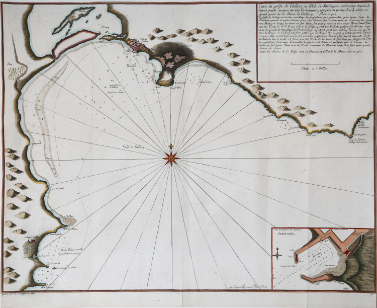
Sea chart from the rare Atlas Recueil de Plusiers Plans des Ports et rades de la Mer Mediterranée, printed in between 1732 and 1746. Jacques Ayrouard, a French hydrographer, worked between 1730 and 1750; the rare Mediterranean harbours atlas is his sole work.
Ayrouard's work forms a working "waggoner" for the coast, recording soundings, anchorages, and pilotage notes on rocks and reefs, and includes a series of coastal profiles as a further aid to navigation. This pilot would subsequently be drawn on by numerous hydrographers, most notably William Heather who cites Ayrouard in his New Mediterranean Pilot of 1802. Ayrouard dedicates the work to Jean Frédérick Phélypeaux, comte de Maurepas, secretary to the royal household and minister of the navy in the court of Louis XV, who was prominent in attempts to introduce a more scientific approach to naval affairs until he was exiled in 1749 for writing derogatory epigrams about the king's mistress, Madame de Pompadour. The Conseil de la Marine, for whom this work appears to have been produced, had been founded in 1720 as a central depository for maps, plans, journals, and memoirs relating to navigation. Of the hydrographer Ayrouard, little is known beyond the brief details he gives on the title where he describes himself as "Royal pilot of the King's Galleys," and explains that these charts were prepared by him on voyages that he undertook on the coast, leading him to add further pilotage notes for the safe entry into certain of the harbours and roads ("avec les Remarques necessaires qu'il faut observer pour l'entrée á Certains Ports et autres Endroits"). Similarly, the engraver of these superbly-detailed charts, Louis Corne, was known to Tooley solely from this work. It is possible that this was a local production, perhaps produced in Marseille, hydrographer and engraver brought together under the aegis of the Conseil de la Marine to produce this pilot for the benefit of visitin
Copperplate with fine later hand colour, in excellent condition.
|
NMM 206; Shirley, British Library, M.AYR-1a.; LC 7862. The Map Collector, Issue 24, p.49.
|
Jacques AYROUARD (Attivo tra il 1730 e il 1750)
|
He was a navigator for the French Royal Navy, in 1720 published Recueil de plusieurs Ports … de la Mer Mediterranee.
|
|
NMM 206; Shirley, British Library, M.AYR-1a.; LC 7862. The Map Collector, Issue 24, p.49.
|
Jacques AYROUARD (Attivo tra il 1730 e il 1750)
|
He was a navigator for the French Royal Navy, in 1720 published Recueil de plusieurs Ports … de la Mer Mediterranee.
|