

| Reference: | MS6394 |
| Author | Pieter VANDER AA |
| Year: | 1720 ca. |
| Zone: | Madagascar |
| Printed: | Leyden |
| Measures: | 370 x 280 mm |


| Reference: | MS6394 |
| Author | Pieter VANDER AA |
| Year: | 1720 ca. |
| Zone: | Madagascar |
| Printed: | Leyden |
| Measures: | 370 x 280 mm |
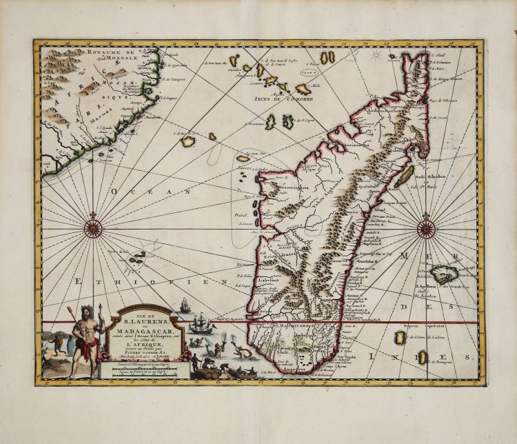
Detailed map of Madagascar and Réunion from Nouvel Atlas, très exact et fort commode pour toutes sortes de personnes, Contenant Les Principales cartes géographiques. Leiden, P. Van der Aa, n.d. (1713) (Koeman, Aa7).
The map was created by Pieter Van der Aa and published in Leiden in 1717 as part of Jean Mandelslo’s “Voyage de Perse aux Indes Orientales.” This epic travelogue details the voyages of Jean-Albert (Johan Albrecht) Mandelslo – a German diplomat who traveled to Russian and Persia in the late 1630’s on a political mission for the Duke of Holstein but was separated from his group. He would carry on through India, Ceylon, and Madagascar before returning home to write about his travels. Information on the Far East, including the Spice Islands, was included in the publication, but garnered from other sources.
Pieter van der Aa was born in Leiden in 1659, became apprenticed to the booksellers trade at age 9 and died in 1733. Many of his atlases were made to order from outdated plates acquired from many of the older well-known cartographers.
Copperplate with fine later hand colour, in good condition.
Pieter VANDER AA (1659 - 1733)
|
Records show that van der Aa, born in Leyden in 1659, made an early start in life by being apprenticed to a bookseller at the age of nine and starting on his own in business as a book publisher by the time he was twenty-three.
During the following fifty years he published an enormous amount of material, including atlases and illustrated works in every shape and size, two of them consisting of no less than 27 and 28 volumes containing over 3,000 maps and plates.
Most of his maps were not of the first quality and were certainly not original, but they are often very decorative and are collected on that account.
|