

| Reference: | s10469 |
| Author | Giovanni Antonio RIZZI ZANNONI |
| Year: | 1783 |
| Zone: | Portugal |
| Printed: | Paris |
| Measures: | 450 x 340 mm |


| Reference: | s10469 |
| Author | Giovanni Antonio RIZZI ZANNONI |
| Year: | 1783 |
| Zone: | Portugal |
| Printed: | Paris |
| Measures: | 450 x 340 mm |
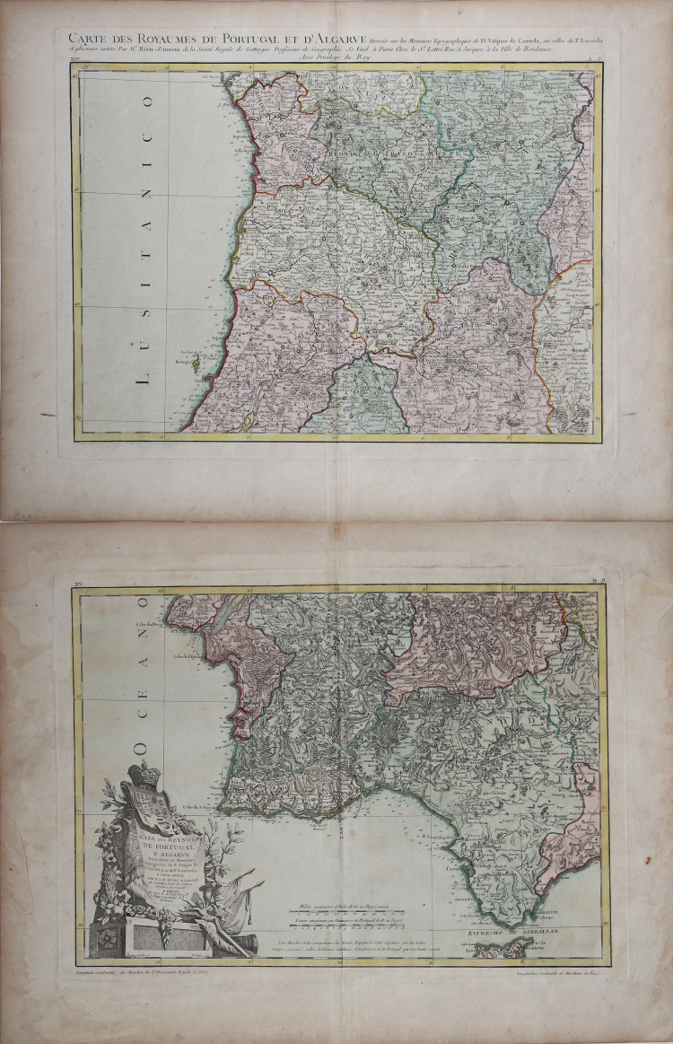
Double page map of Portugal, from Rizzi-Zannoni, the Royal Georgapher of France. One of the most highly detailed large format maps of Portugal published in a commercial atlas during the period.
The northen part covers from just north of Lisbon north to Galicia and east as far as Valladolid, Spain. Engraved in a highly unusual topographic style. Title appears above the upper border of the map.
The other depicts from Lisbon to Gibraltar and from the Atlantic Ocean to Andorra, Spain. A large decorative title cartouche depicting the heraldic crests Portugal and the Algarve appears in the lower left corner.
These maps are two of the most highly detailed maps of northen and southern Portugal to appear in the late 18th century.
Includes exceptional detail, showing towns, roads, rivers, mountains, lakes, and many other minor details. The engraving style is uniquely topographical for the period. Decorative cartouche in original color.
A fine wide margined example, in full original colour. Published in Paris by Lattrè.
Giovanni Antonio RIZZI ZANNONI (1736 - 1814)
|
Rizzi Zannoni was a noted astronomer, surveyor and mathematician of great versatility. His achieevements included a large scale map of Poland, appointmenys as Geographer to the Venetian Republic and as Hydrographer to the Dèpot de Marine in Paris. The maps in his various atlases were beatifully engraved, showing minute details and embellished with elaborate cartouches. His earlier atlases were published in Paris but his later works first appeared in Naples.
Principali pubblicazioni:
1762 Atlas géographique
1763 Atlas Géographique et militaire
1765 Le petit Neptune Francois
1772 Carte Générale de la Pologne
1792 Atlante Maritimo delle due Sicilie
1795 Nuova carta della Lombardia
|