

| Reference: | S39510 |
| Author | Reiner & Joshua OTTENS |
| Year: | 1740 ca. |
| Zone: | Iberian Peninsula |
| Printed: | Amsterdam |
| Measures: | - x - mm |


| Reference: | S39510 |
| Author | Reiner & Joshua OTTENS |
| Year: | 1740 ca. |
| Zone: | Iberian Peninsula |
| Printed: | Amsterdam |
| Measures: | - x - mm |
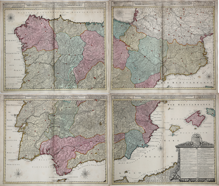
Map of the Iberian Peninsula, printed on four sheets, unjoined. Each map has his own title.
Gorgeous full color example of Luggert van Anse's 4 sheet map of Spain, Portugal and the Balaeric Islands, joined flawlessly and presented here as a wall map.
Includes a large cartouche with explanations of the political divisions of Spain and Portugal in French and Dutch, headed by coat of arms and 6 compass roses. An uncommon wall map of Spain and Portugal. Luggert van Anse was engraver for Allard, Visscher and van Keulen. This edition was published by Ottens, with additions and corrections.
From Atlas minor sive geographia compendiosa in qua orbid terrarum paucis attamen novissimis tablulis ostenditur - Atlas nouveau contenant toutes les parties du monde o๠sont exactement remarquées les empires, monarchies, royaumes,états, républiques, &c. Amsterdam, R. & J. Ottens.
Copper engraving, printed on four sheets (still unjoined, 605mm x 510mm each one), some foxing in the margins, otherwise good condition. Nice original colour.
|
The family business of print and map selling was founded by Joachim Ottens but the active period of map publishing was concentrated in the years between 1720 and 1750 when the brothers, Reiner and Joshua, produced enormous collections of maps, some as large as 15 volumes.
These, including copies of practically all maps available at the time, were made up to order and were magnificently coloured. Besides these specially prepared collections they also issued single-volume atlases with varying contents as well as pocket atlases.
|
|
The family business of print and map selling was founded by Joachim Ottens but the active period of map publishing was concentrated in the years between 1720 and 1750 when the brothers, Reiner and Joshua, produced enormous collections of maps, some as large as 15 volumes.
These, including copies of practically all maps available at the time, were made up to order and were magnificently coloured. Besides these specially prepared collections they also issued single-volume atlases with varying contents as well as pocket atlases.
|