

| Reference: | S42302 |
| Author | Sebastien de Pontault BEAULIEU |
| Year: | 1646 ca. |
| Zone: | Piombino |
| Printed: | Paris |
| Measures: | 540 x 430 mm |


| Reference: | S42302 |
| Author | Sebastien de Pontault BEAULIEU |
| Year: | 1646 ca. |
| Zone: | Piombino |
| Printed: | Paris |
| Measures: | 540 x 430 mm |
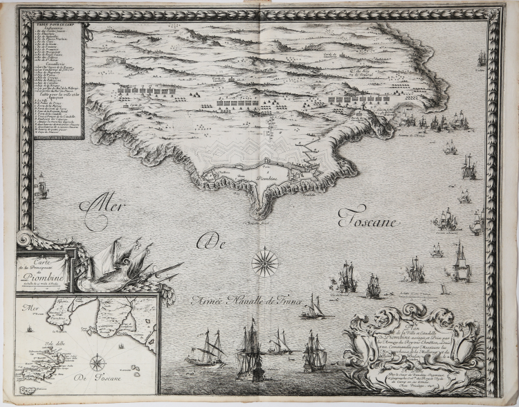
A low-high oblique view of Piombino, a Spanish base on the coast of Tuscany which had been captured by the French in 1646 and shown here, retaken by the Spanish, from 25 May to 8 July in 1650. Franco-Spanish War (1645-1659).
At lower left a cartouche with a map of the Island of Elba and the coast in front with the city of Piombino.
Plate published in the work Les glorieuses conquestes de Louis le Grand roy de France et de Navarre.
Sébastien Pontault de Beaulieu (1612–1674) was an eminent French engineer, who is considered to be the first military topographer, or rather the inventor of that art, during the reign of Louis XIV.
Pontault went into the army at the age of fifteen, and behaved with so much spirit at the siege of Rochelle, that the king gave him the post of commissary of artillery, even though he was so young. He was afterwards present at most of the battles and siege, which he has described, and did not quit a military life until the loss of an arm and other wounds, with the approach of old age, rendered retirement necessary.
Pontault died on 10 August 1674. From the death of this able drafts-man, there were few capable military topographers in France until the latter half of the 18th century. It was Pontault's practice to follow the army, and construct upon the spot plans of the battles and sieges, with historical and perspective accompaniments.
His most important work is entitled Les glorieuses Conquêtes de Louis-le-Grand: ou Recueil, de Plans et Vues des places assiegeés, et de celles ou se_sont douneés des batailles, avec des Discours (The glorious victories of Louis the Great, produced from the drawings of the Chevalier de Beaulieu).
This work is one of the most magnificent of the kind, covers all the operations of war, from the battle of Rocroi, in 1643, to the taking of Namur, in 1692. Pontault died in 1674; but the work was completed to the above date at the expense of his niece, the widow of the sieur Des Roches. This edition is usually called the Grand Beaulieu, to distinguish it from one on a reduced scale, in oblong quarto, called the Petit Beaulieu, of which there are two series, one in three volumes, with views of the actions in the Netherlands; the other in four, which includes those of France.
Each copy contains a different collection of plates; for a detailed description of the BN and BL copies see Pastoreau.
The plates were later used in the publication of the Cabinet du Roi from 1727 onwards and are now housed in the Louvre.
Etching on copper, printed on contemporary laid paper, in very good condition.
Literature
Pastoreau, Les atlas français, Beaulieu XV; Shirley, Maps in the Atlases of the British Library T.BEAU-16a.
Sebastien de Pontault BEAULIEU (1612 - 1674)
|
The work of Earl Beaulieu celebrate the achievements of businesses and Francioa under Louis XIV and are part of the famous "cabinet de Roi. " The famous "Les Glorieuses Conqueste de Louis le Grand" contains 177 plants eved with scenes of battle or siege.
|