

| Reference: | S43060 |
| Author | Giambattista Tonegutti |
| Year: | 1845 ca. |
| Zone: | Delta del Po |
| Measures: | 570 x 490 mm |


| Reference: | S43060 |
| Author | Giambattista Tonegutti |
| Year: | 1845 ca. |
| Zone: | Delta del Po |
| Measures: | 570 x 490 mm |
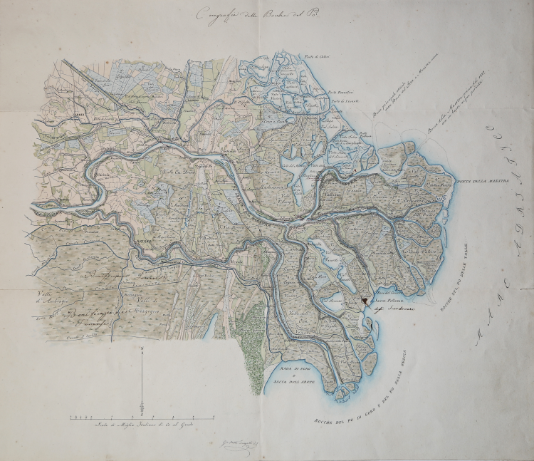
Detailed handwritten survey of the mouth of the Po', extending from the Port of Caleri (north) to the Rada di Goro (south), signed at the bottom center "Gio Batta Tonegutti dis.".
This is a very accurate survey, undated, but probably made shortly before 1845.
By Giambattista Tonegutti is, in fact, known the Carta topografica della Laguna Veneta dal Porto di Caleri a quello di Piave Vecchia con parte dei territoriï adiacente: tratta dalla grande carta del Regno Lombardo Veneto dell'I.R. Istituto topografico militare ... nell'anno 1845 : al chiarissimo signore Pietro Paleocapa ... / in segno di profondo ossequio e riconoscenza dedica, offre e consacra, Gio. Batta. Tonegutti inc. (1845) published by the Litografia Kirchmayr of Venice, with which this map is certainly related.
This is the copy of the Biblioteca Marciana in Venice [Misc. B. 984]:
another copy is preserved at the Library of Congress:
https://lccn.loc.gov/85696504
This manuscript survey would seem to be the natural continuation to the south of the Carta topografica della Laguna Veneta dal Porto di Caleri a quello di Piave Vecchia, which is precisely delimited at the Port of Caleri.
There is no printed version of the manuscript, which is made in ink and watercolor on paper. Repeatedly folded, small woodworm holes, in excellent condition.
Bibliografia
Marinelli (1881): n. 1775; V. Valerio, Cartografi veneti, mappe, uomini e istituzioni per l’immagine e il governo del territorio, 2007, p. 210.
Giambattista Tonegutti(attivo alla metà del XIX secolo)
Giambattista Tonegutti(attivo alla metà del XIX secolo)