

| Reference: | S46645 |
| Author | Angelo Zanovello |
| Year: | 1676 ca. |
| Zone: | Vicenza |
| Printed: | Vicenza |
| Measures: | 525 x 920 mm |


| Reference: | S46645 |
| Author | Angelo Zanovello |
| Year: | 1676 ca. |
| Zone: | Vicenza |
| Printed: | Vicenza |
| Measures: | 525 x 920 mm |
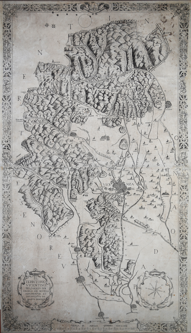
Very rare and important map of the Vicenza area adorned with decorative frame. Drawn by Angelo Zanovello and engraved in copper (two plates) by Marco Boschini. Bears, top center in the frame, a noble coat of arms with three mountains and a cross.
Etching and engraving, ca. 1676, signed in plate in the cartouche at lower left.
The map is undoubtedly inspired by Novam hanc et accuratissimam Territorii Vicentini descriptionem, the map that Filippo Pigafetta published in 1608 and that represents the prototype of maps of the territory of Vicenza. It reveals remarkable cartographic accuracy in the depiction of the territory; in fact, the outcome of the Pigafettian sheet essentially establishes what we might call a kind of centripetal canon of representation, the result of a folded attention to the precise contours of the portion of the Venetian state.
The only reprise of the Pigafettian approach, in the course and continuation of the seventeenth century, is certainly this Territorio Vicentino outlined by Angelo Zanovello (1634-1711) and engraved, around 1676, by the Venetian Marco Boschini (1613-1704), engaged, precisely at that stage, in the capital in the editing of the Gioieli Pittoreschi, a fundamental guide, in many ways, to the public paintings of the city of Vicenza.
Angelo Zanovello was a notary land surveyor, a prominent figure in Montecchio Maggiore, where he carried out prestigious tasks for the local administration. In Vicenza he was a member of the territorial council where he was appointed chancellor. He also performed measurements of agricultural land, as well as drew maps related to territorial disputes and management issues. In this area, too, he demonstrated technical competence in surveying and drawing contours, but also a flair for decoration, according to the Baroque style of the time. He also undertook to draw this map of the entire Vicenza area, which was circulated as the official image of the province that the territorial body wanted to offer.
Marco Boschini was born in Venice in 1613 and at a very young age entered the workshop of Palma il Giovane and later learned the art of carving from Odoardo Fialetti. The date of his death is uncertain: according to Melchiori it was in 1678, while some documents show that he was still alive in 1704. Boschini practiced various activities: his real profession was as a dealer in fake pearls and glass beads. His activity as cosmographer, as he calls himself, or as “geographo,” as Martinioni calls him, is completed with the engraving of the Vicenza territory that Boschini himself tells us about in the foreword to Gioieli Pittoreschi.
Very good impression, on two sheets of contemporary laid paper, several oxidation and traces of glue on verso (the map was previously affixed to antique cloth backing), missing engraved part in ornamental frame, minor defects, otherwise in good condition.
Bibliografia
Catalogue of maps, prints, drawings, etc forming the geographical ..., Volume 2, pag. 443; S. Vantini Angelo Zanovello illustre cartografo e agrimensore nella Montecchio del seicento, 2013.
Angelo Zanovello (1634 - 1711)
|
Angelo Zanovello was a notary land surveyor, a prominent figure in Montecchio Maggiore, where he carried out prestigious tasks for the local administration. In Vicenza he was a member of the territorial council where he was appointed chancellor. He also performed measurements of agricultural land, as well as drew maps related to territorial disputes and management issues. In this area, too, he demonstrated technical competence in surveying and drawing contours, but also a flair for decoration, according to the Baroque style of the time. He also undertook to draw this map of the entire Vicenza area, which was circulated as the official image of the province that the territorial body wanted to offer.
|