

| Reference: | S43672 |
| Author | Athanasius KIRCHER |
| Year: | 1675 |
| Zone: | The World |
| Measures: | 500 x 365 mm |


| Reference: | S43672 |
| Author | Athanasius KIRCHER |
| Year: | 1675 |
| Zone: | The World |
| Measures: | 500 x 365 mm |
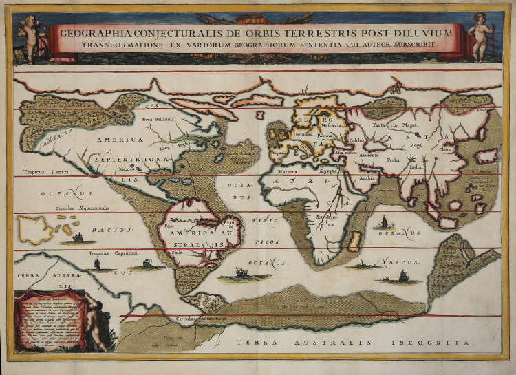
Geographia Conjecturalis De Orbis Terrestris Post Diluvium Transformatione Ex Variorum Geographorum Sententia Cui Author Subscribit.
An unusual map of the world, published not in an atlas but in Kircher's 'Arca Noë', Amsterdam: Jansson van Waesburge, 1675 an analysis of the world before, during and after the Flood. Here Kircher conjectures which parts of the world were flooded, including Atlantis is the middle of the Atlantic.
Athanasius Kircher, German Jesuit, philosopher, historian and museologist, was one of the last representatives of 17th century encyclopaedias. In particular, in this work the author, starting from the biblical account of the Great Flood, attempts to reconcile new biogeographical discoveries with testamentary traditions. Kircher makes an assessment of the real size of the Ark according to the description in the sacred Scriptures, understanding how, in this three-storey ark, only the archetypal species could have found refuge.
Cartographically speaking, the map traces the planisphere that Kircher included in his Mundus Subterraneus (1665), a study on the physical phenomena of the earth, where he theorised that all of the earth's oceans were connected by underground tunnels that joined oceans and seas.
Copperplate engraving, finely coloured by hand, perfectly executed restorations along the graduated margin, otherwise in good condition.
Bibliografia
Shirley, Mapping of the World, n. 470.
Athanasius KIRCHER (Geisa 1601 circa - Roma 1680)
|
German Jesuit educated in Fulda, was one of the most remarkable men of his time, seemingly interested in every aspect of life. He was an expert on China and its languages; Egypt and Ethiopia and the source of the Nile; he translated oriental scripts and hieroglyphics; made a scientific study of the evolution of the earth and its physical features; he wrote a treatise on the reasons of magnetic compass variations; and, in the middle of all of that, found time to invent the magic lantern, for which he is probably best remembered. Maps in his book Mundus Subterraneus were the first to describe tides and ocean currents beside showing the sites of all volcanoes known at that time.
|