

| Riferimento: | S4887 |
| Autore | Gilles Robert de VAUGONDY |
| Anno: | 1750 ca. |
| Zona: | Giappone |
| Luogo di Stampa: | Parigi |
| Misure: | 570 x 505 mm |


| Riferimento: | S4887 |
| Autore | Gilles Robert de VAUGONDY |
| Anno: | 1750 ca. |
| Zona: | Giappone |
| Luogo di Stampa: | Parigi |
| Misure: | 570 x 505 mm |
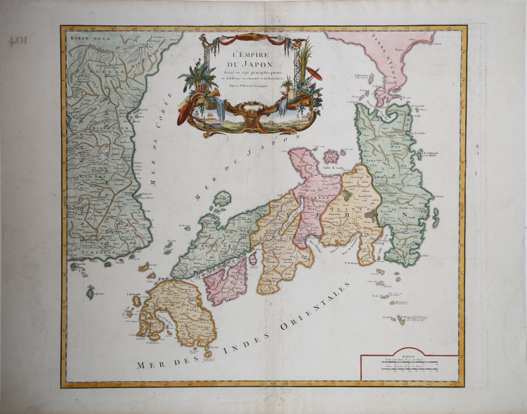
Carta geografica trata da "Atlas Universel.." edito a Parigi nel 1750.
Grande carta del Giappone e della Corea con un cartiglio decorativo col titolo contenente due piccoli paesaggi.
La mappa si basa molto sul precedente lavoro di Bellin, ma include una serie di miglioramenti.
Le province sono chiaramente delineate e sono inclusi molti nomi di luoghi. Anche la parte orientale della penisola coreana viene mostrata con una buona quantità di dettagli.
Questa mappa ha influenzato la cartografia del Giappone fino al XIX secolo.
“The engraver, perhaps Santini himself, responsible for copying De Vaugondy's map, was faithful to the original place-names, keeping all words in French and producing a very close facsimile of the elaborate cartouche. When it came to copying the mountain chains in Japan and Korea he apparently ignored some, such as in the southwest corner of Kyūshū, or reduced their length, as in a number of places in Korea.
The first state was published in an atlas with a title-page dated 1776 although the map bears the date 1778. The atlas was published by the Venetian brothers Francesco, and Paolo Santini, who were editor and engraver, respectively. Paolo Santini (c.1729-1793) was born in Venice and, besides being an engraver and mapmaker, was a professor of design. Valerio (1993) writes that the Santini's were not among the subscribers of Robert de Vaugondy's Atlas Universel and that no documentation appears to exist of an agreement between the French and the Venetian publishers. He goes on to point out that the maps were copied so rigorously, giving full credit as to the source, thus probably saving them from the accusation of plagiarism. The Atlas Universel, writes Valerio, "does not appear to have been a success, and that accounts for the rarity of the first edition..."
Economic circumstances forced Santini to sell the plates in 1781 to Giuseppe Antonio Remondini (1747-1811), who continued publication of the atlas until 1804. Remondini published the atlas in two volumes but made no changes to the map other than adding his name in the cartouche below that of Santini, and placing a binder's direction in the upper right corner. Remondini "...was an audacious and bold publisher in Bassano and Venice" (Valerio 1997). The Remondini's expanded their business in a number of directions including printing, paper production and type foundry work and claimed to have made money from the re-publication of Santini's atlas, with the addition of 12 plates in the second edition of 1784. The atlas was reissued in 1804 by Joseph Remondini and sons." (Hubbard "Japoniae Insulae – The Mapping of Japan", p. 374).
Bibliografia:
Hubbard "Japoniae Insulae – The Mapping of Japan", pp. 374-375, n. 114; Walter "Japan a cartographic vision", p. 223, 100 (cat. N. 86).
Gilles Robert de VAUGONDY (1688 - 1766)
|
Cartografo e geografo (Parigi 1688 - ivi 1766), geografo ufficiale del re di Francia, autore di vari atlanti, tra cui un Atlas universel (1758; ed. più completa, 1786); il figlio Didier (Parigi 1723 - ivi 1784), geografo del re come il padre, ne continuò e perfezionò l'opera, scrisse delle Institutions géographiques (1766) e collaborò all'Encyclopédie e all'Histoire naturelle di Buffon.
|